Lobuche
Lobuche (also spelt Lobuje) is a Nepalese mountain which lies close to the Khumbu Glacier and the settlement of Lobuche. There are two main peaks, Lobuche East and Lobuche West. A permit to climb the mountain is required from the National Mountaineering Association (NMA) of Nepal, which classifies Lobuche East (6,119m) as a "trekking peak", and Lobuche West (6,145m) as an "expedition peak". As the easier, trekking peak, the East peak is climbed far more frequently than the West peak, however most of those climbers only do so to a false summit a few hours from the true summit of Lobuche East. Between the two peaks is a long deeply notched ridge, however a steep drop and considerable distance makes approaching the West peak from the East impossible.[2]
| Lobuche East | |
|---|---|
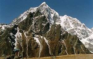 Lobuche East as viewed from Lobuche Alps | |
| Highest point | |
| Elevation | 6,119 m (20,075 ft) (Lobuche East)[1] |
| Prominence | 275 m (902 ft) |
| Coordinates | 27°57′34.2″N 86°47′23.8″E |
| Geography | |
 Lobuche East Location in Nepal | |
| Location | Khumbu, Nepal |
| Parent range | Himalayas |
| Climbing | |
| First ascent | April 25, 1984 |
| Easiest route | Scramble/Rock/Snow Climb |
The first recorded ascent of Lobuche East was made by Laurence Nielson and Sherpa Ang Gyalzen on April 25, 1984.[1]
Lobuje West was first climbed in 1955 via the South Shoulder.
Name Confusion
Many of the tourist operators offering treks and climbs to Lobuje refer to the two peaks as "Lobuche East" and "Lobuche Far East". The NMA - who own the mountain - however, refer to them as Lobuche West and Lobuche East.
References
- "Lobuje". Nepal Mountaineering Association. Retrieved 2018-10-04.
- "NMA Peak Guide". Retrieved 2018-10-04.