Labuche Kang
Labuche Kang (or Lapche Kang, Lobuche Kang I, Choksiam) is a northern outlier of the Himalayas inside Tibet. It rises northwest of Rolwaling Himal and east of Shishapangma. The peak belongs to a little-known section of the Himalaya variously called Labuche Himal, Pamari Himal and Lapchi Kang.[2] that extends from the valley of the Tamakosi River west to the valley of the Sun Kosi and Nyalam Tong La pass where Arniko-Friendship Highway cross the Himalaya. This section extends south into Nepal east of Arniko Highway. It is wholly within the catchment of the Kosi, a Ganges tributary.
| Labuche Kang | |
|---|---|
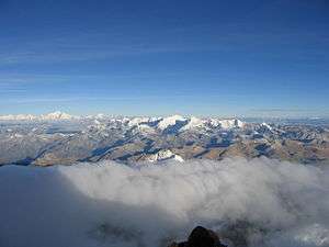 Labuche Kang (Centre) and Shishapangma (left) as seen from Cho Oyu | |
| Highest point | |
| Elevation | 7,367 m (24,170 ft) [1] Ranked 75th |
| Prominence | 1,957 m (6,421 ft) [1] |
| Listing | Ultra |
| Coordinates | 28°18′15″N 86°21′03″E [1] |
| Geography | |
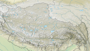 Labuche Kang Location in Tibet, China | |
| Location | Tibet Autonomous Region, China |
| Parent range | Labuche Himal, Himalaya |
| Climbing | |
| First ascent | October 26, 1987 by A. Deuchi, H. Furukawa, K. Sudo (Japanese); Diaqiog, Gyala, Lhaji, Wanjia (Chinese) |
| Easiest route | West Ridge: glacier/snow climb |
Labuche Kang was first climbed in 1987 by a Sino-Japanese expedition, via the West Ridge. No other attempts are recorded[3] until September 2010 when American climber Joe Puryear fell to his death during an unsuccessful attempt.[4]
Video
See also
- List of highest mountains
- List of Ultras of the Himalayas
References
- "China I: Tibet - Xizang". Peaklist.org. Retrieved 2014-05-30.
- H. Adams Carter (1985). "Classification of the Himalaya" (PDF). American Alpine Journal. American Alpine Club. 27 (59): 122. Retrieved May 1, 2011.
- "Himalayan Index". London: Alpine Club. Retrieved May 18, 2011.
- Puryear's accident Archived 2010-10-31 at the Wayback Machine