List of neighbourhoods in Saskatoon
The city of Saskatoon, Saskatchewan, Canada currently has 65 neighbourhoods divided amongst 9 designated Suburban Development Areas (SDAs). Some neighbourhoods underwent boundary and name changes in the 1990s when the City of Saskatoon adjusted its community map.[1]
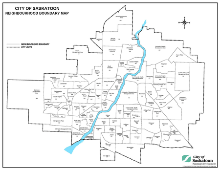
Saskatoon neighbourhood boundaries as of 2014
Definitions
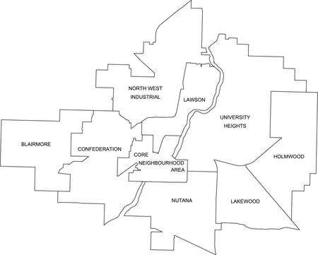
Saskatoon SDA map
- Neighbourhood: the basic unit of residential development, comprehensively planned and maintained over the long term. Many older neighbourhoods were defined by elementary school catchment areas. The boundaries of some neighbourhoods were adjusted when the school boards no longer required students to live in their school catchment area. The boundaries of neighbourhoods are now defined by "natural" barriers such as major streets, railways, and bodies of water.
- Suburban Development Area (SDA): a collection of neighbourhoods organized to facilitate long range planning for infrastructure and related community facilities. Each SDA has approximately ten neighbourhoods, 50,000 people, district and multi-distract parks, a mixed-use suburban centre, and high schools.
- Suburban Centre (SC): a neighbourhood that is the primary mixed-use focal point for a suburban development area. They are designed to provide commercial, institutional and recreational lands serving the basic needs of the SDA. Medium to high density residential development is encouraged within SCs.
- Management Area (MA): a term used to classify areas that are generally not covered by residential, industrial or future development characteristics.
- Development Area: an area within the city limits that is designated for future neighbourhood development.
East
Lakewood SDA
- Briarwood
- College Park
- College Park East
- Hillcrest Management Area
- Lakeridge
- Lakewood Suburban Centre
- Lakeview
- Rosewood
- Wildwood
University Heights SDA
- Arbor Creek
- Aspen Ridge
- Erindale
- Evergreen
- Forest Grove
- Silverspring
- Sutherland
- Sutherland Industrial
- University Heights Suburban Centre
- Willowgrove
- University of Saskatchewan Management Area
- U of S Lands South Management Area
- U of S Lands North Management Area
- University Heights Development Area
- Two future neighbourhoods are planned[4]
West
Blairmore SDA
- Blairmore Suburban Centre
- Elk Point[5]
- Kensington[6]
- Blairmore Development Area
- Six additional future neighbourhoods are planned[4]
Confederation SDA
- AgPro Industrial
- Confederation Park
- Confederation Suburban Centre
- Dundonald
- Fairhaven
- Hampton Village
- Holiday Park
- Hudson Bay Park
- Massey Place
- Meadowgreen
- Montgomery Place
- Mount Royal
- Pacific Heights
- Parkridge
- South West Industrial
- West Industrial
- Westview
- CN Yards Management Area
- Gordie Howe Management Area
- SaskPower Management Area
References
- "Neighbourhood Profiles 2012" (PDF). City of Saskatoon – Planning & Development Branch. 2012. Retrieved 2012-08-14.
- "City of Saskatoon Zoning Map" (PDF). City of Saskatoon. Archived from the original (PDF) on July 14, 2014. Retrieved June 17, 2014.
- "Projected Growth Concept Plan, June 28, 2012" (PDF). City of Saskatoon. Archived from the original (PDF) on September 12, 2014. Retrieved August 18, 2012.
- "City of Saskatoon – Projected Growth Concept Plan" (PDF). City of Saskatoon – Community Services Department – Planning & Development Branch. August 25, 2009. Archived from the original (PDF) on March 12, 2012. Retrieved February 8, 2010.
- Hamilton, Charles (2013-06-04). "New west side suburb dubbed Elk Point". The StarPhoenix. Retrieved 2013-06-05.
- "Kensington Neighbourhood Concept Plan" (PDF). City of Saskatoon. Retrieved 2010-06-07.
External links
| Wikimedia Commons has media related to Neighbourhoods of Saskatoon. |
This article is issued from Wikipedia. The text is licensed under Creative Commons - Attribution - Sharealike. Additional terms may apply for the media files.