List of highways in Brewster County, Texas
The following is a list of all state highways in Brewster County, Texas maintained by the Texas Department of Transportation. All state highways in Texas are paved.
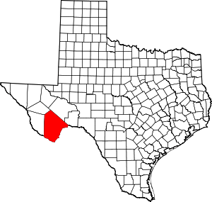
Location of Brewster County
U.S. highways
| Route Name | Direction | Termini | Junctions | Length | Remarks |
|---|---|---|---|---|---|
| S/N | Presidio County to Presidio County |
1.3 miles (2.1 km)[2] | Overlays US 90 and briefly leaves county | ||
| S/N | Presidio County to Pecos County |
37.2 miles (59.9 km)[2] | Passes through Alpine | ||
| W/E | Presidio County to Presidio County |
1.3 miles (2.1 km)[2] | Overlays US 67 and briefly leaves county | ||
| W/E | Presidio County to Pecos County |
70.8 miles (113.9 km)[2] | Passes through Alpine, Marathon | ||
| S/N | Pecos County |
59.1 miles (95.1 km)[5][6][7] | Passes through Marathon |
State highways
| Route Name | Direction | Termini | Junctions | Length | Remarks |
|---|---|---|---|---|---|
| S/N | Jeff Davis County |
89.7 miles (144.4 km)[2] | Passes through Study Butte, Alpine | ||
| S/N | 1.6 miles (2.6 km)[9] | Partial loop around northeast quadrant of Alpine |
Farm and ranch to market roads
| Route Name | Direction | Termini | Junctions | Length | Remarks |
|---|---|---|---|---|---|
| W/E | Presidio County to |
18.0 miles (29.0 km)[2] | Passes through Lajitas, Terlingua to Study Butte | ||
| S/N | Wagon Road |
3.9 miles (6.3 km)[11] | Serves rural subdivision near Alpine | ||
| S/N | La Linda International Bridge to |
28.0 miles (45.1 km)[12] |
Historic roads
| Route Name | Direction | Termini | Remarks |
|---|---|---|---|
| W/E | Presidio County to |
Replaced by US 90 in 1939 | |
| S/N | Pecos County to |
Replaced by US 385 in 1959 | |
| S/N | Santa Elena Canyon |
Portion in Big Bend National Park dropped from description in 1946 Replaced by SH 51 in 1956 | |
| N/S | Jeff Davis County |
Replaced by SH 118 in 1939 | |
| W/E | Terlingua |
Former Terlingua spur of SH 227 in Big Bend National Park before 1946 | |
| S/N | Pecos County to |
Replaced by SH 51 in 1956 |
Adjacent countries and counties
- Pecos County (northeast)
- Terrell County (east)
- Mexico (south)
- Presidio County (west)
- Jeff Davis County (northwest)
References
- Transportation Planning and Programming Division (n.d.). "U.S. Highway No. 67". Highway Designation Files. Texas Department of Transportation.
- Texas Department of Transportation, Statewide Planning Map using map's measurement utility
- Transportation Planning and Programming Division (n.d.). "U.S. Highway No. 90". Highway Designation Files. Texas Department of Transportation.
- Transportation Planning and Programming Division (n.d.). "U.S. Highway No. 385". Highway Designation Files. Texas Department of Transportation.
- Transportation Planning and Programming Division (n.d.). "Farm to Market Road No. 1214". Highway Designation Files. Texas Department of Transportation.
- Google Maps, Map of concurrent section of US 90 and US 385 at Marathon
- Transportation Planning and Programming Division (n.d.). "State Highway No. 227". Highway Designation Files. Texas Department of Transportation.
- Transportation Planning and Programming Division (n.d.). "State Highway No. 118". Highway Designation Files. Texas Department of Transportation.
- Transportation Planning and Programming Division (n.d.). "State Highway No. 223". Highway Designation Files. Texas Department of Transportation.
- Transportation Planning and Programming Division (n.d.). "Farm to Market Road No. 170". Highway Designation Files. Texas Department of Transportation.
- Transportation Planning and Programming Division (n.d.). "Farm to Market Road No. 1703". Highway Designation Files. Texas Department of Transportation.
- Transportation Planning and Programming Division (n.d.). "Ranch to Market Road No. 2627". Highway Designation Files. Texas Department of Transportation.
- Transportation Planning and Programming Division (n.d.). "State Highway No. 3". Highway Designation Files. Texas Department of Transportation.
- Transportation Planning and Programming Division (n.d.). "State Highway No. 51". Highway Designation Files. Texas Department of Transportation.
- Transportation Planning and Programming Division (n.d.). "State Highway No. 233". Highway Designation Files. Texas Department of Transportation.
- Transportation Planning and Programming Division (n.d.). "State Highway Spur No. 121". Highway Designation Files. Texas Department of Transportation.
This article is issued from Wikipedia. The text is licensed under Creative Commons - Attribution - Sharealike. Additional terms may apply for the media files.