List of Blackpool Tramway tram stops
All of the current stops of Blackpool Tramway are listed here, as well as past and future stops.

| Part of a series of articles on |
| Blackpool Tramway |
|---|
|
Main service stops
| Blackpool Tramway | ||||||||||||||||||||||||||||||||||||||||||||||||||||||||||||||||||||||||||||||||||||||||||||||||||||||||||||||||||||||||||||||||||||||||||||||||||||||||||||||||||||||||||||||||||||||||||||||||||||||||||||||||||||||||||||||||||||||||||||||||||||||||||||||||||||||||||||||||||||||||||||||||||||||||||||
|---|---|---|---|---|---|---|---|---|---|---|---|---|---|---|---|---|---|---|---|---|---|---|---|---|---|---|---|---|---|---|---|---|---|---|---|---|---|---|---|---|---|---|---|---|---|---|---|---|---|---|---|---|---|---|---|---|---|---|---|---|---|---|---|---|---|---|---|---|---|---|---|---|---|---|---|---|---|---|---|---|---|---|---|---|---|---|---|---|---|---|---|---|---|---|---|---|---|---|---|---|---|---|---|---|---|---|---|---|---|---|---|---|---|---|---|---|---|---|---|---|---|---|---|---|---|---|---|---|---|---|---|---|---|---|---|---|---|---|---|---|---|---|---|---|---|---|---|---|---|---|---|---|---|---|---|---|---|---|---|---|---|---|---|---|---|---|---|---|---|---|---|---|---|---|---|---|---|---|---|---|---|---|---|---|---|---|---|---|---|---|---|---|---|---|---|---|---|---|---|---|---|---|---|---|---|---|---|---|---|---|---|---|---|---|---|---|---|---|---|---|---|---|---|---|---|---|---|---|---|---|---|---|---|---|---|---|---|---|---|---|---|---|---|---|---|---|---|---|---|---|---|---|---|---|---|---|---|---|---|---|---|---|---|---|---|---|---|---|---|---|---|---|---|---|---|---|---|---|---|---|---|---|---|---|---|---|---|---|---|---|---|---|---|---|---|---|---|---|---|---|
| ||||||||||||||||||||||||||||||||||||||||||||||||||||||||||||||||||||||||||||||||||||||||||||||||||||||||||||||||||||||||||||||||||||||||||||||||||||||||||||||||||||||||||||||||||||||||||||||||||||||||||||||||||||||||||||||||||||||||||||||||||||||||||||||||||||||||||||||||||||||||||||||||||||||||||||
The following is a list of stops with platforms currently served by Blackpool's Flexity 2 fleet, from north to south:[4]
| Stop | Image | Coordinates | Stop Type | Notes |
|---|---|---|---|---|
| Fleetwood Ferry |  |
53.9276°N 3.0080°W |
|
The northern terminus of the tramway. The single platform is located at Bold Street, on a terminal loop of track. Provides a ferry interchange for the service to Knott End.
Most of the loop is on-street but the platform itself and a section at the Pharos Lighthouse are reserved. The loop is single-tracked aside from a double track alignment on Queen's Terrace. |
| Victoria Street |  |
53.9249°N 3.0086°W |
|
Nearest stop to Fleetwood Market.
There is a crossover north of the platforms. |
| London Street |  |
53.9226°N 3.0116°W |
|
|
| Fisherman's Walk |  |
53.9197°N 3.0174°W |
|
Nearest stop to Fleetwood Freeport.
The stop marks the end of the street-running section of track on Lord Street, Fleetwood. There is a crossover northeast of the platforms. |
| Stanley Road |  |
53.9166°N 3.0206°W |
|
Nearest stop to Fleetwood Town FC. |
| Lindel Road | 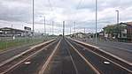 |
53.9136°N 3.0236°W |
|
|
| Heathfield Road |  |
53.9099°N 3.0275°W |
|
|
| Broadwater |  |
53.9039°N 3.0322°W |
|
|
| Rossall Square |  |
53.9006°N 3.0367°W |
|
|
| Rossall School |  |
53.8968°N 3.0395°W |
|
Located at the school's entrance. |
| Rossall Beach | 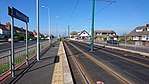 |
53.8876°N 3.0404°W |
|
|
| Thornton Gate | 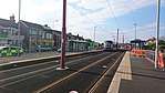 |
53.8833°N 3.0395°W |
|
There is a middle track alignment and crossovers north of the platforms. There was previously a siding at this location. |
| West Drive |  |
53.8802°N 3.0391°W |
|
|
| Cleveleys |  |
53.8776°N 3.0398°W |
|
There is a crossover north of the platforms. |
| Anchorsholme Lane |  |
53.8714°N 3.0427°W |
|
|
| Little Bispham |  |
53.8660°N 3.0476°W |
|
The first stop on the Promenade in Blackpool. It has a station building with toilet facilities on the northbound platform. Some trams from Starr Gate terminate here during the summer and Blackpool Illuminations.
There is a track loop north of the platforms, for northbound turnbacks only. |
| Norbreck North |  |
53.8616°N 3.0489°W |
|
Re-opened in March 2016 after the stop was previously removed as part of the tramway upgrade. |
| Norbreck |  |
53.8578°N 3.0501°W |
|
Located opposite the Norbreck Castle Hotel. |
| Sandhurst Avenue |  |
53.8536°N 3.0518°W |
|
|
| Bispham | 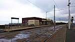 |
53.8493°N 3.0535°W |
|
Located opposite Red Bank Road, Bispham's high street. It has a station building with a cafe and toilet facilities on the northbound platform.
There is a middle track alignment and crossovers north of the platforms. |
| Cavendish Road |  |
53.8466°N 3.0536°W |
|
|
| Lowther Avenue | 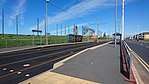 |
53.8420°N 3.0544°W |
|
|
| Cabin | 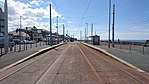 |
53.8381°N 3.0548°W |
|
Also known as Uncle Tom's Cabin.
There is a crossover north of the platforms. |
| Cliffs Hotel |  |
53.8360°N 3.0549°W |
|
|
| Gynn Square |  |
53.8337°N 3.0550°W |
|
|
| Wilton Parade |  |
53.8278°N 3.0556°W |
|
|
| Pleasant Street |  |
53.8252°N 3.0555°W |
|
|
| North Pier Northbound | _tram_stop.jpg) |
53.8197°N 3.0557°W |
|
This stop's platforms are significantly staggered by approximately 200m. The northbound platform is at the Grand Metropole Hotel, while the southbound platform is nearer Blackpool Tower. This is likely due to the future tram link to North Station, as a junction for this extension has been installed between the two platforms.
There is a short siding for heritage trams and two crossovers at the southbound platform. |
| North Pier Southbound | _tram_stop.jpg) |
53.8177°N 3.0561°W | ||
| Tower |  |
53.8145°N 3.0558°W |
|
The stop is in reality located just south of Blackpool Tower.
There is a crossover north of the platforms. |
| Central Pier | 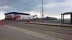 |
53.8118°N 3.0556°W |
|
|
| Manchester Square |  |
53.8080°N 3.0555°W |
|
Located just north of a junction of on-street side track leading to Rigby Road depot, where Blackpool's heritage trams are housed and maintained. There is a siding north of the platforms. |
| St Chad's Road |  |
53.8024°N 3.0556°W |
|
|
| Waterloo Road |  |
53.7989°N 3.0559°W |
|
Nearest stop to Blackpool South railway station. |
| South Pier |  |
53.7959°N 3.0564°W |
|
|
| Pleasure Beach |  |
53.7935°N 3.0567°W |
|
There is a double-track loop south of the platforms which heritage trams use during service, for southbound turnbacks only. |
| Burlington Road West |  |
53.7873°N 3.0583°W |
|
Nearest stop to Blackpool Pleasure Beach railway station. |
| Harrow Place |  |
53.7825°N 3.0580°W |
|
|
| Starr Gate | 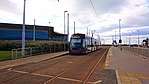 |
53.7779°N 3.0560°W |
|
The southern terminus of the tramway. The Starr Gate depot is located here, where the Flexity 2 fleet are housed and maintained. Nearest stop to Squires Gate railway station.
There is a track loop, crossovers and headshunts here as part of the depot layout. |
Heritage tram stops
Blackpool's heritage trams do not serve the main service platforms, instead having separate designated stops. The following is a list of stops used by them, from north to south:[6]
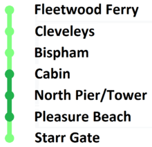
- Fleetwood Ferry
- Cleveleys
- Bispham
- Cabin
- North Pier
- On a track siding.
- Pleasure Beach
- On a track loop.
Starr Gate is also used as a temporary stop during special events.
Former stops
Stops removed by tramway upgrade
The following is a list of stops removed in 2011-2012 during the tramway modernisation, from north to south:[7]
- Pharos Street
- Church Street
- Preston Street
- Lingfield Road
- Southfleet Avenue
- Westbourne Road
- Westmorland Avenue
- Beach Road
- Lauderdale Avenue
- Melton Place
- Norkeed Road
- Leyburn Avenue
- Madison Avenue
- Miner's Home
- St Stephen's Avenue
- Warley Road
- Imperial Hotel
- Cocker Street
- Victoria Street (Blackpool)
- Foxhall Square
- Lytham Road
- On the section of track leading to Rigby Road depot.
- Barton Avenue
- Alexandra Road
- Star Hotel
- Harrowside
- Abercorn Place
Future stops
North Station extension
| Stop | Image | Coordinates | Stop Type | Notes |
|---|---|---|---|---|
| Talbot Square |  |
53.8191°N 3.0545°W |
|
Eastbound-only stop in Talbot Square which will allow passengers to alight for Blackpool Town Centre. It is situated on a reserved track segment at the beginning of the street track section on Talbot Road. Unusually, there is no stop sign or shelter.
It is due to open in 2020. |
| North Station | 53.8210°N 3.0500°W |
|
Expected to be new terminus providing an interchange with national rail services at Blackpool North via a pedestrian underpass. It will be situated on a reserved track segment on the site of an existing homeware store.
It will be located near a scissors crossover, and will be the only island platform on the network. It is due to open in 2020. |
See also
- Blackpool Tramway
- Flexity 2 (Blackpool)
References
- Blackpool Gazette (27 February 2019). "'Significant progress' made on Blackpool town centre investment plans". www.blackpoolgazette.co.uk.
- "Tram Fleetwood to Starr Gate". Blackpool Transport Services Ltd. Retrieved 11 March 2018.
- "Timetables & Fares". Blackpool Heritage Tram Tours. Retrieved 11 March 2018.
- "Tram route stops". Blackpooltransport.com. Archived from the original on 29 September 2013. Retrieved 16 February 2015.
- "Timetables & Fares". Blackpoolheritage.com. Retrieved 10 February 2017.
- "Heritage Trams". Blackpooltransport.com. Archived from the original on 29 March 2017. Retrieved 10 February 2017.
- "Tram Stops : Blackpool Tramway : TheTrams.co.uk". Thetrams.co.uk. Retrieved 16 February 2015.
- "Tramway terminal centre of Talbot Gateway phase two".