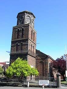
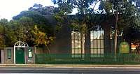
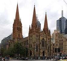
List of Anglican churches in Melbourne

This is a list of Anglican churches in Melbourne. It covers all metropolitan and suburban areas which have a postcode, excluding the rural areas added to the city in 2009.

Congregation Image Suburb/
Coordinates
Parish Notes
St George'sIvanhoe East, Victoria
BrimbankKeilor East
Anglican Parish of Brimbank
City on a Hill: MelbourneMelbourne CBD
Holy TrinityDoncaster
37°47′16.09″S 145°8′17.32″E
Holy TrinityEast Ringwood
37°48′41.69″S 145°14′55.72″E
Holy TrinityWilliamstown
37°51′36.57″S 144°54′5.8″E
Erected in 1871.
Saint Andrew'sRosanna
37°44′30.96″S 145°3′43.74″E
Anglican Parish of Banyule
Saint Augustine'sCoburg
37°45′9.45″S 144°57′53.21″E
Erected in 1918.
Saint Bartholomew'sBurnley
37°49′23.9″S 145°0′26.2″E
Erected in 1884.
Saint George'sMalvern
37°51′19.02″S 145°1′48.28″E
Erected in 1865.
Saint Hilary'sKew
37°48′41″S 145°3′9″E
Saint James' (Old Cathedral)Melbourne
37°42′26″S 144°56′18″E
Completed in 1847.
Saint James the GreatSt Kilda East
37.86713°S 145.00333°E / -37.86713; 145.00333
St Kilda EastErected 1915.
Saint James'Glen Iris
37°51′32.28″S 145°3′3.39″E
Saint John'sFrankston North
38°7′8.35″S 145°8′57.07″E
Saint John'sHeidelberg
37°45′23.95″S 145°4′19.72″E
Erected in 1848.
St Jude'sCarlton
37°47′46.5″S 144°58′2.68″E
Erected in 1874.
Saint Mark's Anglican ChurchTemplestowe
37°45′55.83″S 145°7′12.8″E
Anglican Parish of TemplestoweFirst established as Christ Church in 1900 after operating from a school building from 1854. Moved to current site and name changed in 1975.
Saint Matthew'sGlenroy
37°42′13.70″S 144°55′26.16″E
Saint Matthew'sWheelers Hill
37°54′37.44″S 145°10′42.78″E
Saint Michael's Anglican ChurchCarlton North
37°47′6.23″S 144°58′5.70″E
Erected in 1885.
Saint Oswald'sGlen Iris
37°51′45.6″S 145°4′14.32″E
Saint Paul's CathedralMelbourne
Saint Paul'sRingwood
37°48′34.81″S 145°13′51.53″E
Mullum Mullum Anglican Parish (Ringwood)
Saint Peter'sBundoora
37°41′59.07″S 145°3′35.54″E
Saint Peter'sBox Hill
37°49′8.6″S 145°7′38.65″E
Saint Philip'sBox Hill North
37°48′3.03″S 145°7′34.59″E
Saint Stephen'sWarrandyte
37°44′31.56″S 145°12′34.34″E
Saint Thomas'Werribee
37°54′24.51″S 144°39′17.02″E
Erected in 1900. Extended in the 1940/50s.
Saint Timothy'sBulleen
37°46′20.31″S 145°5′46.74″E
Saint John'sDiamond Creek
37°40′24.52″S 145°8′59.00″E
Saint Alfred'sBlackburn North
St. Andrew'sBrighton
St. John'sCamberwell
St. Andrew'sBlackburn North
St. John'sCamberwell
This article is issued from Wikipedia. The text is licensed under Creative Commons - Attribution - Sharealike. Additional terms may apply for the media files.