Limbongan, Brunei
Limbongan was a neighbourhood in Kampong Ayer, the riverine stilt settlement in Bandar Seri Begawan, the capital of Brunei. It was officially a village subdivision under Tamoi, a mukim (subdistrict) of Brunei-Muara District, and had the postcode BL1312.[1][2] Limbongan was one of the traditional stilt neighbourhoods which had existed along the banks of the Kedayan River, a tributary of the Brunei River in the vicinity of Kampong Ayer, before they were eventually demolished in the 2010s and redeveloped into Taman Mahkota Jubli Emas, a riverfront park.[3]
Limbongan | |
|---|---|
 Location in Brunei | |
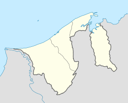
| Coordinates: 4°53′16″N 114°56′09″E | |
| Country | Brunei |
| District | Brunei-Muara |
| Mukim | Tamoi |
| Ceased to exist | 2010s |
| Postcode | BL1312 |
Etymology
"Limbongan" is the former spelling of the Malay word "limbungan" which literally means 'dockyard'.[4]
References
- "Brunei Postal Services - postcodes". post.gov.bn. Retrieved 2018-04-13.
- "Kampong Limbongan, Tamoi, Brunei Muara: BL1312 | Brunei Postcode". brn.postcodebase.com. Retrieved 2018-04-13.
- "A beacon of Bandar's revitalisation – Borneo Bulletin Online". Borneo Bulletin Online. 2017-10-23. Retrieved 2018-04-13.
- "Carian Umum". prpm.dbp.gov.my (in Malay). Retrieved 2018-04-13.
This article is issued from Wikipedia. The text is licensed under Creative Commons - Attribution - Sharealike. Additional terms may apply for the media files.