Lichtenhain/Bergbahn
Lichtenhain/Bergbahn is a former municipality in the district Saalfeld-Rudolstadt, in Thuringia, Germany. Since 1 December 2008, it is part of Oberweißbach.
Lichtenhain/Bergbahn | |
|---|---|
Village of Oberweißbach | |
 Station of Lichtenhain/Bergbahn | |
 Coat of arms | |
Location of Lichtenhain/Bergbahn 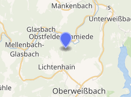
| |
 Lichtenhain/Bergbahn  Lichtenhain/Bergbahn | |
| Coordinates: 50°36′0″N 11°7′59″E | |
| Country | Germany |
| State | Thuringia |
| District | Saalfeld-Rudolstadt |
| Town | Oberweißbach |
| Area | |
| • Total | 3.26 km2 (1.26 sq mi) |
| Elevation | 640 m (2,100 ft) |
| Population (2006-12-31) | |
| • Total | 351 |
| • Density | 110/km2 (280/sq mi) |
| Time zone | CET/CEST (UTC+1/+2) |
| Postal codes | 98744 |
| Dialling codes | 036705 |
| Vehicle registration | SLF |
| Website | Official website |
History
Lichtenhain/Bergbahn was first mentioned in 1455 and is located on the ancient trade route from Erfurt to Nuremberg. It once belonged to the sovereignty of Schwarzburg-Rudolstadt, later to the Principality of Schwarzburg-Rudolstadt. In the Thirty Years' War the town was completely devastated. The main source of income of the residents was originally forestry, charcoal burning and resin extraction. Later the trading of nature medicines ("Olitäten") became a major economic driver. In 1812 Lichtenhain/Bergbahn counted 375 inhabitants which rose to 524 in 1902.[1] In 1923, the Oberweißbacher mountain railway opened which connected Lichtenhain with national railway network. Major industries in modern times were the glass industry and the thermometer production, after the Second World War, increasingly tourism.
The municipality Lichtenhain/Bergbahn was disbanded on 1 December 2008 and incorporated into the city of Oberweißbach.[2] with administrative headquarters in Oberweißbach.
Politics
The Council of the municipality Lichtenhain/Bergbahn consisted recently (as of the municipal election on 27 June 2004) of 6 Women and councilors.
- SPD 3 seats
- FW 3 seats
Ingo Lödel, the last honorary mayor, was elected on 27 June 2004.
Coat of arms
|
Blazon: "Divided and split half; up in blue a rising golden lion with red knocked-tongue and reinforcement, bottom front in gold a red heart with red flames, down the back in red a golden arnica montana." |
| Description: The coat of arms was designed by Frank Heraldiker Diemar and approved by the Thuringian State Administration on 30 September 1994. |
Transportation
Lichtenhain/Bergbahn is connected to Oberweißbacher Bergbahn which connects Obstfelderschmiede (Mellenbach-Glasbach) with the village Cursdorf. The train consists of 1.351 km broad gauge cable railway and a connecting 2.635 km standard gauge electronic adhesion railway.[3] The railway is operated by Deutsche Bahn AG and offers about thirty rides every half hour from 5:30 am to 8:00 pm.
.jpg)
References
- Elsäßer, Elsäßer (1929). Das Kirchspiel Oberweißbach im Wandel der Zeiten. Ein Rückblick zur 150. Wiederkehr des Tages der Einweihung der Kirche zu Oberweißbach mit kurzer Chronik der Kirchspielorte Oberweißbach, Cursdorf, Deesbach, Lichtenhain und Leibis. Oberweissbach. pp. Elsäßer.
- StBA: Änderungen bei den Gemeinden Deutschlands, siehe 2008
- "Oberweißbacher Berg- und Schwarzatalbahn". www.oberweissbacher-bergbahn.com. Retrieved 2015-11-24.
- http://www.marionrosin.de/index.php?nr=1430&menu=1 Archived 2016-03-04 at the Wayback Machine Botz wird SPD-Kandidat für die Bundestagswahl
External links
![]()
| Authority control |
|
|---|