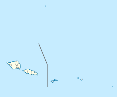
Lepa, Samoa
Lepea is a small village at the southeastern end of Upolu island in Samoa. The village has a population of 170 (2006 Census).[1] It is also the name of an electoral faipule district, Lepea Electoral Constituency, which consists of 6 villages, including Lepea village, with a total population of 1,429. (2006 Census).[1]
Lepea | |
|---|---|
Village & Electoral Constituency | |
 Lepea | |
| Coordinates: 14°2′43″S 171°26′27″W | |
| Country | |
| District | Atua |
| Population (2006) | |
| • Total | 1,429 Constituency |
| Time zone | -11 |
The village and Lepea Electoral Constituency are part of the larger political district of Atua.
Lepa Electoral Constituency
The six villages within Lepa Electoral Constituency includes the settlements of A'ufaga, Lealatele and Saleapaga.[1]
Lepa is the birthplace of Samoan Prime Minister Tuilaepa Aiono Sailele Malielegaoi.[2]
The Lepa area was extensively damaged in the 2009 Samoa earthquake and tsunami. Most of Lepa village was destroyed, leaving just the church and the village's welcome sign standing.[3]
See also
- Archaeology in Samoa
References
- "Population and Housing Census Report 2006" (PDF). Samoa Bureau of Statistics. July 2008. Archived from the original (PDF) on 21 July 2011. Retrieved 19 December 2009.
- "Samoa - Head of Government". Commonwealth Secretariat. Retrieved 2008-11-12.
- McClean, Tamara (2009-10-02). "Searching ruins for reason to live after the tsunami". The Daily Telegraph. Retrieved 2009-10-05.
Traditional center: Lufilufi | ||
| Villages | 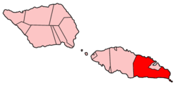 | |
| Landmarks | ||
| Islands |
| |
| Environment | ||
| Electoral constituencies: Faipule Districts |
| |