Lechtal Alps
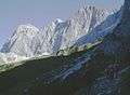
The Lechtal Alps (German: Lechtaler Alpen) are a mountain-range in western Austria, and part of the greater Northern Limestone Alps range. Named for the Lech River which drains them north-ward into Germany, the Lechtal Alps occupy the Austrian states of Tyrol and Vorarlberg and are known for their diverse rock structure.
| Lechtal Alps | |
|---|---|
| German: Lechtaler Alpen | |
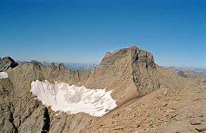 Parseierspitze with Grinner Glacier | |
| Highest point | |
| Peak | Parseierspitze |
| Elevation | 3,036 m (9,961 ft) |
| Coordinates | 47°10′28″N 10°28′42″E |
| Geography | |
| Country | Austria |
| States | Tyrol and Vorarlberg |
| Parent range | Northern Limestone Alps |
| Borders on | Allgäu Alps and Ammergau Alps |
Peaks
- Parseierspitze, 3,040 metres (9,970 ft)
- Dawinkopf, 2,970 metres (9,740 ft)
- Südlicher Schwarzer Kopf, 2,949 metres (9,675 ft)
- Gatschkopf, 2,947 metres (9,669 ft)
- Bocksgartenspitze, 2,939 metres (9,642 ft)
- Holzgauer Wetterspitze, 2,898 metres (9,508 ft)
- Oberer Bocksgartenkopf, 2,888 metres (9,475 ft)
- Vorderseespitze, 2,888 metres (9,475 ft)
- Freispitze, 2,887 metres (9,472 ft)
- Eisenspitze, 2,859 metres (9,380 ft)
- Große Schlenkerspitze, 2,827 metres (9,275 ft)
- Fallenbacherspitze, 2,723 metres (8,934 ft)
External links

This article is issued from Wikipedia. The text is licensed under Creative Commons - Attribution - Sharealike. Additional terms may apply for the media files.