Leadville North, Colorado
Leadville North is a census-designated place (CDP) in Lake County, Colorado, United States. The population was 1,794 at the 2010 census,[1] down from 1,942 at the 2000 census.
Leadville North, Colorado | |
|---|---|
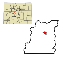 Location in Lake County and the state of Colorado | |
| Coordinates: 39°15′27″N 106°18′5″W | |
| Country | |
| State | |
| County | Lake |
| Area | |
| • Total | 2.5 sq mi (6.6 km2) |
| • Land | 2.5 sq mi (6.6 km2) |
| • Water | 0.0 sq mi (0.0 km2) |
| Elevation | 10,080 ft (3,070 m) |
| Population (2010) | |
| • Total | 1,794 |
| • Density | 704/sq mi (271.7/km2) |
| Time zone | UTC-7 (Mountain (MST)) |
| • Summer (DST) | UTC-6 (MDT) |
| ZIP code | 80461 |
| FIPS code | 08-44375 |
Geography
Leadville North is located in north-central Lake County at 39°15′27″N 106°18′5″W (39.257605, -106.301383).[2] It is bordered to the south by the city of Leadville, the county seat.
U.S. Route 24 forms the eastern edge of the community. The highway leads north 31 miles (50 km) over the Continental Divide to Interstate 70 at Minturn, and it runs south through Leadville 35 miles (56 km) to Buena Vista. Colorado State Highway 91 has its southern terminus in Leadville North and leads north-northeast 22 miles (35 km) to Interstate 70 at Copper Mountain.
According to the United States Census Bureau, the Leadville North CDP has a total area of 2.5 square miles (6.6 km2), all of it land.[1]
Demographics
| Historical population | |||
|---|---|---|---|
| Census | Pop. | %± | |
| U.S. Decennial Census[3] | |||
As of the census[4] of 2000, there were 1,942 people, 711 households, and 521 families residing in the CDP. The population density was 759.1 people per square mile (292.9/km²). There were 802 housing units at an average density of 313.5 per square mile (121.0/km²). The racial makeup of the CDP was 83.68% White, 0.10% African American, 1.60% Native American, 0.51% Asian, 0.05% Pacific Islander, 11.53% from other races, and 2.52% from two or more races. Hispanic or Latino of any race were 34.14% of the population.
There were 711 households out of which 39.7% had children under the age of 18 living with them, 59.1% were married couples living together, 9.3% had a female householder with no husband present, and 26.6% were non-families. 18.3% of all households were made up of individuals and 4.1% had someone living alone who was 65 years of age or older. The average household size was 2.73 and the average family size was 3.09.
In the CDP, the population was spread out with 28.8% under the age of 18, 11.4% from 18 to 24, 32.5% from 25 to 44, 21.7% from 45 to 64, and 5.6% who were 65 years of age or older. The median age was 30 years. For every 100 females, there were 109.0 males. For every 100 females age 18 and over, there were 114.6 males.
The median income for a household in the CDP was $40,027, and the median income for a family was $42,258. Males had a median income of $32,424 versus $24,615 for females. The per capita income for the CDP was $19,847. About 6.4% of families and 9.4% of the population were below the poverty line, including 9.1% of those under age 18 and 3.6% of those age 65 or over.
See also
- Outline of Colorado
- State of Colorado
- Colorado cities and towns
- Colorado census designated places
- Colorado counties
- Colorado metropolitan areas
- Colorado cities and towns
References
- "Geographic Identifiers: 2010 Census Summary File 1 (G001), Leadville North CDP, Colorado". American FactFinder. U.S. Census Bureau. Archived from the original on February 13, 2020. Retrieved September 11, 2019.
- "US Gazetteer files: 2010, 2000, and 1990". United States Census Bureau. 2011-02-12. Retrieved 2011-04-23.
- "Census of Population and Housing". Census.gov. Retrieved June 4, 2016.
- "U.S. Census website". United States Census Bureau. Retrieved 2008-01-31.
Municipalities and communities of Lake County, Colorado, United States | ||
|---|---|---|
| City | 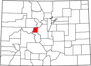 Map of Colorado highlighting Lake County | |
| CDPs | ||
| Ghost towns | ||