Lashmeet, West Virginia
Lashmeet is a census-designated place (CDP) in western Mercer County, West Virginia, United States. It lies along West Virginia Route 10 northwest of the city of Princeton, the county seat of Mercer County.[3] Its elevation is 2,539 feet (774 m).[4] Although Lashmeet is unincorporated, it has a post office, with the ZIP code of 24733.[5] As of the 2010 census, its population was 479.[2]
Lashmeet | |
|---|---|
Census-designated place (CDP) | |
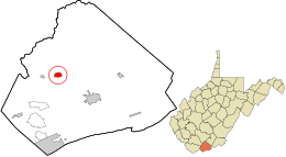 Location in Mercer County and the state of West Virginia. | |
| Coordinates: 37°25′15″N 81°11′57″W | |
| Country | United States |
| State | West Virginia |
| County | Mercer |
| Area | |
| • Total | 0.750 sq mi (1.94 km2) |
| • Land | 0.750 sq mi (1.94 km2) |
| • Water | 0 sq mi (0 km2) |
| Population (2010)[2] | |
| • Total | 479 |
| • Density | 640/sq mi (250/km2) |
| Time zone | UTC-5 (Eastern (EST)) |
| • Summer (DST) | UTC-4 (EDT) |
| ZIP codes | 24733 |
The community most likely derives its name from the local Lashmeet (or Lashmutt) family.[6]
References
- "US Gazetteer files: 2010, 2000, and 1990". United States Census Bureau. 2011-02-12. Retrieved 2011-04-23.
- "U.S. Census website". United States Census Bureau. Retrieved 2011-05-14.
- DeLorme. West Virginia Atlas & Gazetteer. 4th ed. Yarmouth: DeLorme, 2007, p. 59. ISBN 0-89933-327-3.
- U.S. Geological Survey Geographic Names Information System: Lashmeet, West Virginia, Geographic Names Information System, 1980-06-27. Accessed 2008-06-02.
- Zip Code Lookup
- Kenny, Hamill (1945). West Virginia Place Names: Their Origin and Meaning, Including the Nomenclature of the Streams and Mountains. Piedmont, WV: The Place Name Press. p. 360.
Municipalities and communities of Mercer County, West Virginia, United States | ||
|---|---|---|
| Cities | 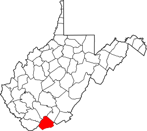 Mercer County map | |
| Towns | ||
| CDPs | ||
| Other communities |
| |
| Ghost town | ||
| Footnotes | ‡This populated place also has portions in an adjacent county or counties | |
This article is issued from Wikipedia. The text is licensed under Creative Commons - Attribution - Sharealike. Additional terms may apply for the media files.