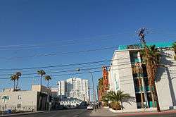
Las Vegas High School Neighborhood Historic District
Las Vegas High School Neighborhood Historic District, is listed on the National Register of Historic Places as a district.[2] The Las Vegas High School Academic Building and Gymnasium is included within the district.
Las Vegas High School Neighborhood Historic District | |
 | |
  | |
| Location | E. Bridger, S. 9th, E. Gass and S. 6th Streets Las Vegas, Nevada |
|---|---|
| Coordinates | 36°9′44″N 115°8′23″W |
| Architectural style | Pueblo |
| NRHP reference No. | 90002204[1] |
| Added to NRHP | January 30, 1991 |
When nominated, the area included 236 properties of which 4 were listed on the National Register of Historic Places and a total of 150 properties were contributing properties.[3]
Boundary
Gass Avenue to 6th Street to Garces Avenue to 8th Street to Garces Avenue, north to Clark Avenue to 8th Street to Bridger Avenue to Chef Andre Rochet Place West to 6th Street to Bonneville Avenue south to Garces Avenue, south and then east to 7th Street and back to Garces Avenue.[4]
References
- "National Register Information System". National Register of Historic Places. National Park Service. July 9, 2010.
- "Clark County". State of Nevada. 2008-07-31. Archived from the original on 2011-07-25. Retrieved 2008-10-12.
- "Las Vegas High School Neighborhood Historic District Registration Form" (PDF). Retrieved 2009-10-30.
- "Las Vegas High School Neighborhood Historic District" (PDF). The City of Las Vegas. 2007-05-17. Retrieved 2009-10-30.
This article is issued from Wikipedia. The text is licensed under Creative Commons - Attribution - Sharealike. Additional terms may apply for the media files.