Lake Bullen Merri
Lake Bullen Merri and it's smaller northern neighbour Lake Gnotuk are a pair of crater lakes near Camperdown in south western Victoria, Australia.
| Lake Bullen Merri | |
|---|---|
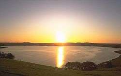 Lake Bullen Merri at sunset | |
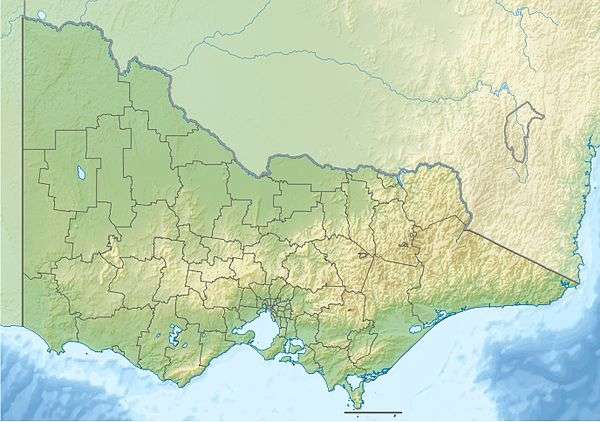 Lake Bullen Merri Location in Victoria | |
| Location | Southwest Victoria |
| Coordinates | 38°15′06″S 143°06′15″E[1] |
| Type | Brackish crater lake |
| Basin countries | Australia |
| Average depth | 60 m (200 ft) |
| Max. depth | 66 m (217 ft) |
Lake Bullen Merri has brackish water quality whereas Lake Gnotuk is hyper saline (twice as salty than seawater).
Lake Bullen Merri
Lake Bullen Merri has a maximum depth of 66 m (217 ft), with a clover leaf outline indicating that it was probably formed by two overlapping maar volcanoes. The lake is depicted in work by Eugene von Guerard.[2] The edge of the lake was marked by a stone in the late 1800s by James Dawson; from this and von Guerard's painting, it can be deduced that the level of the lake has dropped considerably in the last 100 years.[3] On the south side of the lake there is a yacht club and toilets. There is a boat ramp available for the boaties.
Lake Gnotuk
The smaller lake to the north of Lake Bullen Merri has a maximum depth of 20 m (66 ft). The two lakes are linked by an overflow channel in the common wall at an elevation of 175 m. There is a 19th century record of water from Bullen Merri overflowing into Gnotuk.
Inside the crater of Gnotuk is Camperdown's sporting grounds. There is a 18 hole golf course, two cricket ovals (one is turf), and an equestrian course for horse enthusiasts. The crater is 2 km across and although the lakes have the same level of their lake-beds the level of water is lower in Gnotuk. Lake shore terraces indicate previous higher levels and lake floor sediments and fossils show a record of past fluctuations in salinity, water level and climate.[4]
There is no direct public access to the water edge of the lake.
References
- "Lake Bullen Merri". Vicnames. Government of Victoria. 2 May 1966. Archived from the original on 6 June 2014. Retrieved 4 June 2014.
- Lakes and Craters Precinct:Lake Bullen Merri, Kanawinka Geopark
- "Volcanic landforms in the Camperdown area of Victoria". UniServe Science. Retrieved 16 June 2007.
- http://vro.agriculture.vic.gov.au/DPI/Vro/coranregn.nsf/pages/corangamite_eruption_points_gnotuk
External links
- Lake Bullenmerrie, southwest of Camperdown., Three craters 3.2km by 2.8km are surrounded by a prominent tuff-ring. (Oblique aerial photo) Museum Victoria
| |||||||||||||||||
| |||||||||||||||||
| |||||||||||||||||