Kuningan
Kuningan (Sundanese: ᮊᮥᮔᮤᮍᮔ᮪) is a town and district located in eastern West Java, Indonesia, between Cirebon and Tasikmalaya, about 200 km east of Jakarta. It is the administrative center of Kuningan Regency. The district is located east of Mount Cereme/Ciremai (3.078 m), the highest mountain in West Java. The eastern part of the district is a valley. The district's landmark is a horse, called Kuda Kuningan[2] and its motto is Kuningan Aman (Safe) Sehat (Healthy) Rindang (Leafy) Indah (Beautiful), abbreviated as Kuningan ASRI.[3]
Kuningan ᮊᮥᮔᮤᮍᮔ᮪ | |
|---|---|
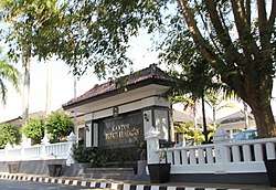 Regent Office of Kuningan Regency | |
| Coordinates: 6°59′S 108°29′E | |
| Country | |
| Province | West Java |
| District | Kuningan Regency |
| Government | |
| • Camat | Jojo Juharsa Kasiran |
| • Secretary | Dudi Sudiana |
| Area | |
| • Total | 29.75 km2 (11.49 sq mi) |
| Elevation | 450 m (1,480 ft) |
| Population (2018)[1] | |
| • Total | 94,246 |
| • Density | 3,200/km2 (8,200/sq mi) |
| Time zone | UTC+7 (IWT) |
| Website | Official website |
Administrative divisions
Kuningan District is divided into 16 villages which are as follows:[1]
- Ancaran
- Awirarangan
- Cibinuang
- Cigintung
- Cijoho
- Ciporang
- Cirendang
- Citangtu
- Karangtawang
- Kasturi
- Kedungarum
- Kuningan
- Padarek
- Purwawinangun
- Winduhaji
- Windusengkahan
References
- "Kuningan Subdistrict in Figures 2018". Statistics Indonesia. Retrieved November 17, 2018.
- "Lambang Daerah | Pemerintah Kabupaten Kuningan". www.kuningankab.go.id (in Indonesian). Retrieved 2018-11-17.
- "Sasanti Daerah dan Moto Juang Kuningan | Pemerintah Kabupaten Kuningan". www.kuningankab.go.id (in Indonesian). Retrieved 2018-11-17.
| Wikivoyage has a travel guide for Kuningan. |
| Wikimedia Commons has media related to Kuningan. |
This article is issued from Wikipedia. The text is licensed under Creative Commons - Attribution - Sharealike. Additional terms may apply for the media files.