Kulpmont, Pennsylvania
Kulpmont is a borough in Northumberland County, Pennsylvania, United States. The population was 2,924 at the 2010 census.
Kulpmont, Pennsylvania k-town | |
|---|---|
 West Chestnut Street | |
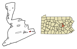 Location of Kulpmont in Northumberland County, Pennsylvania. | |
 Kulpmont Location on Kulpmont in Pennsylvania  Kulpmont Kulpmont (the United States) | |
| Coordinates: 40°47′35″N 76°28′24″W | |
| Country | United States |
| State | Pennsylvania |
| County | Northumberland |
| Incorporated | 1915 |
| Government | |
| • Type | Borough Council |
| • Mayor | Nicholas Bozza |
| Area | |
| • Total | 0.96 sq mi (2.49 km2) |
| • Land | 0.96 sq mi (2.49 km2) |
| • Water | 0.00 sq mi (0.00 km2) |
| Elevation [2] (center of borough) | 1,100 ft (300 m) |
| Highest elevation [2] (northern boundary of borough) | 1,280 ft (390 m) |
| Lowest elevation [2] (southern boundary at Quaker Run) | 1,060 ft (320 m) |
| Population (2010) | |
| • Total | 2,924 |
| • Estimate (2018)[3] | 2,769 |
| • Density | 2,919.79/sq mi (1,127.45/km2) |
| Time zone | UTC-5 (Eastern (EST)) |
| • Summer (DST) | UTC-4 (EDT) |
| Zip code | 17834 |
| Area code(s) | 570 and 272 (570 Exchange: 373) |
| FIPS code | 42-40584 |
| Website | Kulpmont |
History
The Borough of Kulpmont was incorporated August 24, 1915. Its development was aided by Monroe H. Kulp.
Geography
Kulpmont is located at 40°47′35″N 76°28′24″W (40.793177, -76.473440).[4]
According to the United States Census Bureau, the borough has a total area of 0.9 square miles (2.3 km2), all of it land.
Demographics
| Historical population | |||
|---|---|---|---|
| Census | Pop. | %± | |
| 1920 | 4,695 | — | |
| 1930 | 6,120 | 30.4% | |
| 1940 | 6,159 | 0.6% | |
| 1950 | 5,199 | −15.6% | |
| 1960 | 4,288 | −17.5% | |
| 1970 | 4,026 | −6.1% | |
| 1980 | 3,675 | −8.7% | |
| 1990 | 3,233 | −12.0% | |
| 2000 | 2,985 | −7.7% | |
| 2010 | 2,924 | −2.0% | |
| Est. 2018 | 2,769 | [3] | −5.3% |
| Sources:[5][6][7] | |||
As of the census[6] of 2000, there were 2,985 people, 1,338 households, and 837 families residing in the borough. The population density was 3,189.6 people per square mile (1,226.1/km2). There were 1,532 housing units at an average density of 1,637.0 per square mile (629.3/km2). The racial makeup of the borough was 98.89% White, 0.47% African American, 0.03% Asian, 0.23% from other races, and 0.37% from two or more races. Hispanic or Latino of any race were 0.54% of the population.
There were 1,338 households, out of which 22.6% had children under the age of 18 living with them, 49.5% were married couples living together, 9.5% had a female householder with no husband present, and 37.4% were non-families. 34.5% of all households were made up of individuals, and 20.0% had someone living alone who was 65 years of age or older. The average household size was 2.22 and the average family size was 2.85.
In the borough the population was spread out, with 19.6% under the age of 18, 5.7% from 18 to 24, 25.3% from 25 to 44, 24.1% from 45 to 64, and 25.3% who were 65 years of age or older. The median age was 45 years. For every 100 females, there were 92.1 males. For every 100 females age 18 and over, there were 87.1 males.
The median income for a household in the borough was $29,263, and the median income for a family was $34,674. Males had a median income of $26,679 versus $22,075 for females. The per capita income for the borough was $16,033. About 6.7% of families and 9.8% of the population were below the poverty line, including 11.0% of those under age 18 and 10.1% of those age 65 or over.
Government
The mayor of Kulpmont is Bernie Novakoski The borough is served by 7 council people. They are:
- Joseph A. Winhofer
- Clarence H. Deitrick
- Bruno R. Varano
- Nicholas Bozza
- James Wisloski
- Stephanie Niglio
- Philip Scicchitano
Education
Kulpmont is served by the Mount Carmel Area School District.
Notable person
- Joe Baksi (1922-1977) was a top heavyweight boxing contender
- Antoinette Bach (1943-2014) was an active participant in Kulpmont history. Her husband, John Bach, was given a key to the city and she herself was an active member in the community and church. She is dearly missed.
- Bob Chesney (1977- ) Current head football coach at College of the Holy Cross (FCS Division 1).
References
- "2017 U.S. Gazetteer Files". United States Census Bureau. Retrieved Mar 24, 2019.
- "Marion Heights Topo Map, Northumberland County PA (Mount Carmel Area)". TopoZone. Locality, LLC. Retrieved 28 November 2019.
- "Population and Housing Unit Estimates". Retrieved November 25, 2019.
- "US Gazetteer files: 2010, 2000, and 1990". United States Census Bureau. 2011-02-12. Retrieved 2011-04-23.
- "Census of Population and Housing". U.S. Census Bureau. Retrieved 11 December 2013.
- "U.S. Census website". United States Census Bureau. Retrieved 2008-01-31.
- "Incorporated Places and Minor Civil Divisions Datasets: Subcounty Resident Population Estimates: April 1, 2010 to July 1, 2012". Population Estimates. U.S. Census Bureau. Archived from the original on 11 June 2013. Retrieved 11 December 2013.
External links
Municipalities and communities of Northumberland County, Pennsylvania, United States | ||
|---|---|---|
| Cities |  | |
| Boroughs | ||
| Townships | ||
| CDPs | ||
| Unincorporated communities | ||
| Authority control |
|
|---|