Ku Kaeo District
Ku Kaeo District (Thai: กู่แก้ว, pronounced [kùː kɛ̂ːw]) is a district (amphoe) in central Udon Thani Province, northeastern Thailand.
Ku Kaeo กู่แก้ว | |
|---|---|
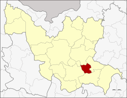 District location in Udon Thani Province | |
| Coordinates: 17°10′20″N 103°9′11″E | |
| Country | Thailand |
| Province | Udon Thani |
| Seat | Ban Chit |
| Area | |
| • Total | 181.2 km2 (70.0 sq mi) |
| Population (2005) | |
| • Total | 21,962 |
| • Density | 121.2/km2 (314/sq mi) |
| Time zone | UTC+7 (ICT) |
| Postal code | 41130 |
| Geocode | 4124 |
Geography
Neighboring districts are (from the north clockwise): Nong Han, Chai Wan, Si That, Kumphawapi, and Prachaksinlapakhom.
History
The minor district (king amphoe) was established on 30 April 1994 by splitting it from Nong Han District.[1]
On 15 May 2007 all 81 Thai minor districts were upgraded to full districts.[2] On 24 August the upgrade became official.[3]
Administration
The district is divided into four sub-districts (tambons), which are further subdivided into 37 villages (mubans). There are no municipal (thesaban) areas, and four tambon administrative organizations (TAO).
| No. | Name | Thai name | Villages | Pop. | |
|---|---|---|---|---|---|
| 1. | Ban Chit | บ้านจีต | 8 | 5,581 | |
| 2. | Non Thong In | โนนทองอินทร์ | 8 | 4,489 | |
| 3. | Kho Yai | ค้อใหญ่ | 6 | 3,634 | |
| 4. | Khon Sai | คอนสาย | 15 | 8,258 |
References
- ประกาศกระทรวงมหาดไทย เรื่อง แบ่งเขตท้องที่อำเภอหนองหาน จังหวัดอุดรธานี ตั้งเป็นกิ่งอำเภอกู่แก้ว (PDF). Royal Gazette (in Thai). 111 (42 ง): 26. May 26, 1994.
- แถลงผลการประชุม ครม. ประจำวันที่ 15 พ.ค. 2550 (in Thai). Manager Online.
- พระราชกฤษฎีกาตั้งอำเภอฆ้องชัย...และอำเภอเหล่าเสือโก้ก พ.ศ. ๒๕๕๐ (PDF). Royal Gazette (in Thai). 124 (46 ก): 14–21. August 24, 2007.
External links
This article is issued from Wikipedia. The text is licensed under Creative Commons - Attribution - Sharealike. Additional terms may apply for the media files.