Kotidanga Rural LLG
Kotidanga Rural LLG is a local-level government (LLG) of Gulf Province, Papua New Guinea.[1][2]
Kotidanga Rural LLG | |
|---|---|
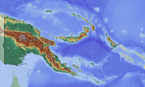 Kotidanga Rural LLG Location within Papua New Guinea | |
| Coordinates: 7.569125°S 145.891264°E | |
| Country | Papua New Guinea |
| Province | Gulf Province |
| Time zone | UTC+10 (AEST) |
Wards
- 01. Kanabea
- 02. Ipaiyu
- 03. Manimango
- 04. Wemawa
- 05. Komako
- 06. Kwaiyu
- 07. Bu'u
- 08. Pio (Tainae language] speakers)
- 09. Anea (Tainae language] speakers)[3][4]
- 10. Aminauwa
- 11. M'bauya
- 12. Ivandu
- 13. Hawakabia
- 14. Kamina
- 15. Tiawa
- 16. Paina
- 17. Meiwari
- 18. Kutumbaiwa
- 19. Kotidanga
- 20. Ipaea
References
- "Census Figures by Wards – Southern Region". www.nso.gov.pg. 2011 National Population and Housing Census: Ward Population Profile. Port Moresby: National Statistical Office, Papua New Guinea. 2014.
- "Final Figures". www.nso.gov.pg. 2011 National Population and Housing Census: Ward Population Profile. Port Moresby: National Statistical Office, Papua New Guinea. 2014.
- Eberhard, David M.; Simons, Gary F.; Fennig, Charles D., eds. (2019). "Papua New Guinea languages". Ethnologue: Languages of the World (22nd ed.). Dallas: SIL International.
- United Nations in Papua New Guinea (2018). "Papua New Guinea Village Coordinates Lookup". Humanitarian Data Exchange. 1.31.9.
- OCHA FISS (2018). "Papua New Guinea administrative level 0, 1, 2, and 3 population statistics and gazetteer". Humanitarian Data Exchange. 1.31.9.
- United Nations in Papua New Guinea (2018). "Papua New Guinea Village Coordinates Lookup". Humanitarian Data Exchange. 1.31.9.
This article is issued from Wikipedia. The text is licensed under Creative Commons - Attribution - Sharealike. Additional terms may apply for the media files.