Kolåstinden
Kolåstinden is a mountain in Ørsta Municipality in Møre og Romsdal county, Norway. The 1,432-metre (4,698 ft) tall mountain is located where the Romedalen and Standaldalen valleys converge, about 5.5 kilometres (3.4 mi) west of the village of Store Standal and the Hjørundfjorden and it is about 12 kilometres (7.5 mi) northeast of the village of Ørsta.
| Kolåstinden | |
|---|---|
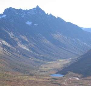 Kolåstinden and Romedalen | |
| Highest point | |
| Elevation | 1,432 m (4,698 ft) |
| Prominence | 1,160 m (3,810 ft) |
| Isolation | 11 to 13 km (6.8 to 8.1 mi) |
| Coordinates | 62.2587°N 6.3106°E[1] |
| Geography | |
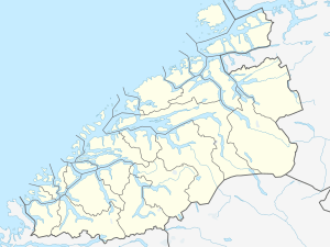 Kolåstinden Location of the mountain  Kolåstinden Kolåstinden (Norway) | |
| Location | Møre og Romsdal, Norway |
| Parent range | Sunnmørsalpene |
| Topo map | 1219 IV Sykkylven |
The summit is most easily reached from the area around Standalhytta på Standaleidet. It is easiest to reach the peak in the winter and spring on skis, in the summer ropes are recommended for the glacier crossing.[2]
See also
- List of mountains of Norway
References
- "Kolåstinden, Ørsta (Møre og Romsdal)" (in Norwegian). yr.no. Retrieved 2019-09-15.
- Dyer, Anthony; Baddeley, John; Robertson, Ian H. (2006). Walks and Scrambles in Norway. Rockbuy Limited. ISBN 978-1-904466-25-3.
This article is issued from Wikipedia. The text is licensed under Creative Commons - Attribution - Sharealike. Additional terms may apply for the media files.