Kogi, Kogi State
Kogi is a Local Government Area in Kogi State, Nigeria bounded by Niger State and the Niger River in the west, the Federal Capital Territory in the north, Nasarawa State in the east and the Benue River to its confluence with the Niger in the south. Its headquarters are in the town of Koton Karfe (or Koton Karifi) on the A2 highway.
Kogi | |
|---|---|
LGA | |
 Kogi Location in Nigeria | |
| Coordinates: 8°06′N 6°48′E | |
| Country | |
| State | Kogi State |
| Area | |
| • Total | 1,498 km2 (578 sq mi) |
| Population (2006 census) | |
| • Total | 115,900 |
| Time zone | UTC+1 (WAT) |
| 3-digit postal code prefix | 260 |
| ISO 3166 code | NG.KO.KO |
It has an area of 1,498 km² and a population of 115,900 at the 2006 census.[1]
The postal code of the area is 260.[2]
References
- HASC, population, area and Headquarters Statoids
- "Post Offices- with map of LGA". NIPOST. Archived from the original on 2012-11-26. Retrieved 2009-10-20.
State capital: Lokoja | ||
| Local Government Areas | 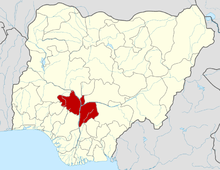 | |
This article is issued from Wikipedia. The text is licensed under Creative Commons - Attribution - Sharealike. Additional terms may apply for the media files.