Kireçburnu, Sarıyer
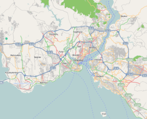
Kireçburnu is a neighborhood of Sarıyer district in Istanbul Province, Turkey. It is located on the northern shore of Bosphorus at European side..[1]. Siteated at about 41°08′N 29°03′E, It is to the north of İstanbul centrum with a distance over 15 kilometres (9.3 mi).
Kireçburnu | |
|---|---|
Neighborhood | |
A view from the Bosphorus shore at Kireçburnu. | |
 Kireçburnu | |
| Coordinates: 41°08′33″N 29°02′45″E | |
| Country | |
| Region | Marmara |
| Province | Istanbul |
| District | Sarıyer |
| Time zone | UTC+2 (EET) |
| • Summer (DST) | UTC+3 (EEST) |
| Postal code | 34457 |
| Area code | 0–212 |
During the Byzantine Empire era Kireçburnu was a village named Kleidai tou Pontou. During the construction of Rumeli Castle by the Ottoman Sultan Mehmet II, the limekilns in the village were used as the construction material of the castle. [2] Turkish for lime is kireç and for cape is burun and eventually the village was called Kireçburnu. As the urban fabrik of İstanbul expanded Kireçburnu became a neighborhood of the city.
Kireçburnu is bordered by Tarabya in the south. The neighborhood is well known for its fish food restaurants.
Sports
The local sports club Kireçburnu Spor is active in football only. Its women's team was promoted from the Second League to the Turkish Women's First Football League for the 2015–16 season.[3]
Transport
Kireçburnu is served by following city line buses:[4]
- 25A – Rumeli Kavağı – Hacıosman Metro
- 25E – Sarıyer – Kabataş
- 25Y – Hacıosman Metro -Sarıyer – Yunus Emre – Uyum Sitesi*
- 40 – Rumelifeneri – Garipçe – Taksim
- 40B – Sarıyer – Beşiktaş
- 42T – Bahçeköy – Taksim
References
- Map page
- İstanbul guide (in Turkish)
- "Beşiktaş ve Ağrı Birlikspor Kadınlar 2.Ligi'ne yükseldi" (in Turkish). Türkiye Futbol Federasyonu. 2015-04-25. Retrieved 2015-05-20.
- "Kireçburnu Durağından Geçen Hatlar" (in Turkish). İETT. Retrieved 2015-05-20.