Kingston, Nevada
Kingston is an unincorporated town and census-designated place in Lander County, Nevada, United States.[1] The population of the census-designated place of Kingston was 113 at the 2010 census.[2]
Kingston, Nevada | |
|---|---|
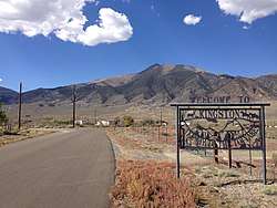 Entrance to Kingston from Nevada State Route 376. Bunker Hill is visible in the background. | |
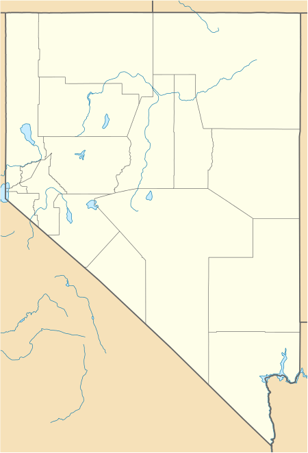 Kingston Location of Kingston, Nevada | |
| Coordinates: 39°12′21″N 117°5′19″W | |
| Country | United States |
| State | Nevada |
| Area | |
| • Total | 4.1 sq mi (10.5 km2) |
| • Land | 4.1 sq mi (10.5 km2) |
| • Water | 0 sq mi (0 km2) |
| Elevation | 6,140 ft (1,870 m) |
| Population (2010) | |
| • Total | 113 |
| • Density | 28/sq mi (11/km2) |
| Time zone | UTC-8 (Pacific (PST)) |
| • Summer (DST) | UTC-7 (PDT) |
| ZIP code | 89310 |
| Area code(s) | 775 |
| FIPS code | 32-38100 |
| GNIS feature ID | 0862179 |
Geography
Kingston is located in southern Lander County on the northeast side of the Toiyabe Range. Bunker Hill, the highest peak in Lander County, is located just a few miles to the northwest. Nevada State Route 376 runs past the community, leading north towards Austin, 20 miles (32 km) away, and south 90 miles (140 km) to Tonopah.
According to the U.S. Census Bureau, the Kingston CDP has an area of 4.1 square miles (10.5 km2), all land.[2]
References
- "Lander County Code of Ordinances - Section 13.32.030 - Powers of district". Municode. Retrieved October 15, 2017.
- "Geographic Identifiers: 2010 Demographic Profile Data (G001): Kingston CDP, Nevada". U.S. Census Bureau, American Factfinder. Archived from the original on February 12, 2020. Retrieved January 25, 2013.
See also
Municipalities and communities of Lander County, Nevada, United States | ||
|---|---|---|
| Unincorporated towns |  Lander County map | |
| Ghost towns | ||
| Wikimedia Commons has media related to Kingston, Nevada. |
This article is issued from Wikipedia. The text is licensed under Creative Commons - Attribution - Sharealike. Additional terms may apply for the media files.