King Christian X Land
King Christian X Land (Danish: Kong Christian X Land) is an area of northeastern Greenland.[1]
- Not to be confused with King Christian IX Land
King Christian X Land Kong Christian X Land | |
|---|---|
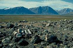 Landscape of King Christian X Land in Wollaston Foreland. | |
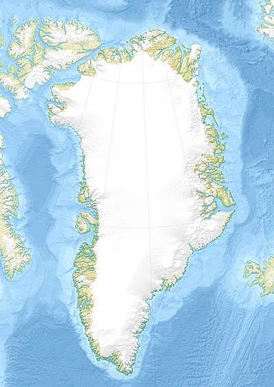 Location of King Christian X Land | |
| Country | Greenland |
| Elevation | 1,000 m (3,000 ft) |
History
This area was named after King Christian X of Denmark and Iceland (1870 – 1947), who rose to the throne in 1912. At the time of the Three-year Expedition to East Greenland it is reported that when Lauge Koch was planning to fly over the region in 1932 he said:
Let’s get this over with this as quickly as possible and then we can call the whole thing King Christian X Land.[2]
The name 'King Christian X Land' was first used on the 1932 1:1 million scale Danish Geodesic Institute map.[2] At that time the area was occupied by Norway and was renamed 'Erik the Red's Land' (Eirik Raudes Land) but the Permanent Court of International Justice ruled against Norway in 1933 and the country subsequently abandoned its claims.[3]
Myggbukta was a Norwegian radio and weather station that operated in the coast intermittently during the 20th century.[4]
Geography
King Christian X Land stretches above the Arctic Circle between the Scoresby Sound at 70°N and the Bessel Fjord at 76°N. It is bordered by King Christian IX Land on the south, King Frederick VIII Land to the north, and the Greenland Ice Sheet to the west. All its territory is included in the large Northeast Greenland National Park zone.[5]
It includes the Stauning Alps, Scoresby Land, as well as the vast glacier and fjord expanses of northeastern Greenland between the ice sheet area west of the Kaiser Franz Joseph Fjord and the eastern end of Wollaston Foreland in the shore of the Greenland Sea.[1]
The area is uninhabited except for the Zackenberg research facility located near the Zackenberg mountain.[6] and the Mestersvig military outpost.
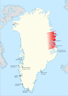
 Limits of King Christian X Land. |
 Norwegian-occupied Erik the Red's Land (1931-1933) |
 Map of Northeastern Greenland. |
References
- "Kong Christian X Land". Mapcarta. Retrieved 21 April 2016.
- "Catalogue of place names in northern East Greenland". Geological Survey of Denmark. Retrieved 21 April 2016.
- Legal Status of Eastern Greenland Archived 2011-05-11 at the Wayback Machine, PCIJ Series A/B No. 53 (1933)
- Spencer Apollonio, Lands That Hold One Spellbound: A Story of East Greenland, 2008 p. 187
- Greenland Map
- Zackenberg Research Station