Killywaum
Killywaum (from Irish: Coill an Mháma meaning ‘Wood of the Chasm) is a townland in the civil parish of Templeport, County Cavan, Ireland. It lies in the Roman Catholic parish of Templeport and barony of Tullyhaw.
Geography
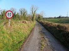
Killywaum is bounded on the north by Corneen and Gowlagh North townlands, on the west by Killycrin and Kilsallagh townlands and on the southwest by Munlough North townland. Its chief geographical features are a stream and cow pastures. The Ordnance Survey Namebooks for 1836 state- There is a light soil intermixed with boulders of free stone. Killywaum is traversed by the national secondary N87 road (Ireland), minor roads and rural lanes. The townland covers 102 statute acres.[1]
History
Until after the Cromwellian Act for the Settlement of Ireland 1652, the townland of Killywaum formed a sub-division of Kilsallagh townland and its history is the same up until then.
The 1652 Commonwealth Survey lists the townland as Kilmame, with the proprietor being Mr Thomas Worsopp and the tenant being William Lawther, both of whom appear as proprietor and tenant for several other Templeport townlands in the same survey.
A deed by John Enery dated 13 December 1774 includes the lands of Killiwamey otherwise Killywaine.[2]
The 1790 Cavan Carvaghs list spells the name as Kilvome.[3]
A lease dated 17 September 1816 by John Enery of Bawnboy includes Killywamey otherwise Killawam.[4]
The Tithe Applotment Books for 1827 list seventeen tithepayers in the townland.[5]
The Killywaum Valuation Office Field books are available for December 1839.[6]
Griffith's Valuation of 1857 lists fourteen landholders in the townland.[7]
Census
| Year | Population | Males | Females | Total Houses | Uninhabited |
|---|---|---|---|---|---|
| 1841 | 57 | 33 | 24 | 8 | 0 |
| 1851 | 48 | 29 | 19 | 7 | 0 |
| 1861 | 44 | 23 | 21 | 9 | 0 |
| 1871 | 27 | 12 | 15 | 6 | 0 |
| 1881 | 29 | 13 | 16 | 5 | 0 |
| 1891 | 16 | 8 | 8 | 3 | 0 |
In the 1901 census of Ireland, there are three families listed in the townland [8] and in the 1911 census of Ireland, there are only two families listed in the townland.[9]
References
- "IreAtlas". Thecore.com. Retrieved 29 February 2012.
- "Memorial extract — Registry of Deeds Index Project". irishdeedsindex.net.
- "A List Of The Several Baronies And Parishes in the County Of Cavan" (PDF). Cavanlibrary.ie. Retrieved 9 April 2019.
- "Memorial extract — Registry of Deeds Index Project". Irishdeedsindex.net. Retrieved 9 April 2019.
- "The Tithe Applotment Books, 1823-37". Titheapplotmentbooks.nationalarchives.ie. Retrieved 9 April 2019.
- "Griffith's Valuation". Askaboutireland.ie. Retrieved 9 April 2019.
- "National Archives: Census of Ireland 1911". Census.nationalarchives.ie. Retrieved 9 April 2019.
- "National Archives: Census of Ireland 1911". Census.nationalarchives.ie. Retrieved 9 April 2019.
External links
Places in County Cavan | ||
|---|---|---|
| Towns |  | |
| Villages |
| |
| Townlands | ||
| ||