Kilbirnie
Kilbirnie (Gaelic: Cill Bhraonaigh) is a small town of 7,642[1] inhabitants situated in the Garnock Valley area of North Ayrshire, on the west coast of Scotland. It is around 20 miles (30 km) south-west of Glasgow and approximately 10 miles (16 km) from Paisley and Irvine respectively. Historically, the town's main industries were flax production and weaving before iron and steelmaking took over in the 19th and early 20th centuries. The suburb of Kilbirnie in the New Zealand capital of Wellington is named after the town.
Kilbirnie
| |
|---|---|
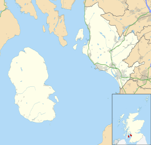 Kilbirnie Location within North Ayrshire | |
| Population | 7,642 |
| OS grid reference | NS315545 |
| • Edinburgh | 60 mi (97 km) |
| • London | 348 mi (560 km) |
| Council area | |
| Lieutenancy area | |
| Country | Scotland |
| Sovereign state | United Kingdom |
| Post town | KILBIRNIE |
| Postcode district | KA25 |
| Dialling code | 01505 |
| Police | Scotland |
| Fire | Scottish |
| Ambulance | Scottish |
| UK Parliament | |
| Scottish Parliament | |
History

Archaeological digs conducted in the 19th century have shown that the area was inhabited during the Bronze Age. A crannog with a connecting causeway was discovered in Kilbirnie Loch. The town derived its name from the parish church, the "Auld Kirk". In 1740 there were only three houses; the population grew to 959 people by 1801. Half a century later, and the town had grown substantially. In 1851 Kilbirnie contained 5,484 people, due to the Industrial Revolution, hastened by the locality of the Ayr and Glasgow railways. During this time the town was a hub of industrial activity with 2 flax-spinning mills, linen-thread mills, wincey factories, 5 fishing-net factories, 2 rope-works, engineering works, mines and ironworks. The steelworks opened in 1841 and quickly became the main industry in the area causing an inpouring of people and during the early to mid 20th Century the town grew to its height of around 10,000 people. However, the industry entered a decline and was eventually closed. The Decoy Bride a film starring David Tennant and Kelly Macdonald was partially filmed in Kilbirnie.
The town was hit particularly hard by the closure of traditional industries. In addition Kilbirnie has highest bankruptcy rate in Scotland. Kilbirnie has a rate of 71 insolvencies per 10,000 people, just ahead of Clydebank and Gorebridge.
Industry
Glengarnock Steelworks
Glengarnock Steel Works opened its blast furnaces around 1841 which caused a massive influx of people from all over the country, as well as all over the world. Initially these works were owned by Merry & Cunninghame before being taken over by David Colville & Sons and eventually nationalised as part of British Steel Corporation and finally closed in 1985. The steelworks in Glengarnock provided employment for most men of the community. The entire collection of staff magazines of the steelworks at Glengarnock have been preserved and are held at the Mitchell Library. This provides content such as spotlights on employees and departments, and contains photographs over 100 years old.

W & J Knox Threadmills
These mills are famous for their nets, used by the British Army and BT Tower. They are one of very few companies in the United Kingdom who have expertise in this area. W & J Knox Threadmills was owned by the Knox family who were prominent, not only in Ayrshire but in the South of England too, becoming important members of society. Some of the mansion houses they built still remain, the Knox Institute was donated by a member of the Knox family and housed Kilbirnie's first public library and one of the cemeteries in the town contains an underground vault where the family are interred, next to the main Knox monument. Who's Who editions of the period list many members of the family.
Modern day
Since the closure of the steel works in the 1980s, the area has been an unemployment blackspot with distinct social problems. The town has very few local employers, and people generally commute out of the town to work. Glengarnock railway station serves the town and has three trains per hour to Paisley and Glasgow. There are regular bus services to Glasgow, Paisley, Largs and Irvine provided by Western Buses and McGill's.
Social history
Swinging Sixties and regeneration
Amongst many other old buildings in the Town, stands the Walker Hall, a memorial hall dedicated to Dr Walker, one of the first physicians in the town. In the 1950s and '60s it was a famous concert venue, coming second only to the Barrowlands. Famous bands to have played the hall include Gerry & The Pacemakers and Bill Haley & His Comets. These days however, it houses the town's Citizens Advice Bureau. Other sources of entertainment in the 1950s and 60s included two cinemas, both of which have long since closed. One of these cinemas is now the Radio City . An Association was formed in 1998 to identify ways of providing much needed local facilities. During the 1997 election campaign, Brian Wilson met with a group of local teenagers who stressed the need for facilities, and plans were developed to provide a Healthy Living Centre which would include fitness facilities, internet access, a healthy eating cafe and child care. Bids for funding were made to private organisations and the National Lottery.
Saint Brennan's Day Fair and Robert Burns
The fair was considered the largest horse market in the west of Scotland. Robert Burns refers to the town in his poem "The Inventory" about a plough-horse that he purchased at the fair:
"My furr-ahin 's a wordy beast, As e'er in tug or tow was traced. The fourth's a Highland Donald hastle, A damn'd red-wud Kilburnie blastie!"
Local football team Kilbirnie Ladeside F.C. derive their sobriquet "the blasties" from the poem, a suitable appellation and an epithet which remains to this day due to the town's past of steel and iron production, as a reference to the blast furnaces.
Notable residents
- Jameson Clark, actor, starring in films such as Whisky Galore!
- James Jameson, Surgeon General, Army Medical Service
- Joanne Love, footballer
- Gordon McQueen, former Scotland, Manchester United and Leeds United footballer and Sky Sports Presenter.
- Julie Peacock, Regional Correspondent BBC Reporting Scotland
- George Stevenson, former Scotland and Motherwell F.C. footballer, went on to be the club's most successful manager
- Allan Wilson, Politician, former Labour Member of the Scottish Parliament and Scottish Government Minister.
Places of worship
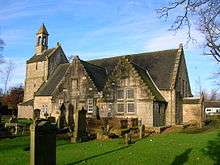
Auld Kirk
The "Auld Kirk" is one of the oldest churches in Scotland still in use both pre-and post-Reformation. Robert Burns allegedly came to the blacksmiths near the Kirk. It is from this Church that Kilbirnie takes its name.
Roman Catholic Church St Brigids
Father Thomas P Lee, a young Irish priest, was sent in 1859 to be the resident priest in Kilbirnie. It is unclear how he raised the money to build the church. He chose St. Brigid (devotion to the poor) to be the patron saint of the parish. Opened in 1862. The current parish priest is Father Mark Kelly.
Gospel Hall
Tracing its roots back to 1889, a full history of the assembly can be found in the middle if the article here:- http://www.plymouthbrethren.org/article/5989
Education
Primary education
- Moorpark Primary School, accessed from Milton Road or School Road by students, was opened in 1978 to replace Ladyland School built in 1869 and Bridgend School built in 1893. The school is located east of its namesake Moorpark House and is adjacent to local secondary school Garnock Academy
- Glengarnock Primary School has from 10 January 2017 been situated in the Garnock Community Campus.[3]
- Saint Bridget's Primary School, located on Hagthorne Avenue, educates local Roman Catholic and Christian children. This location opened in October 1963 replacing the 1894 building. Secondary level Catholic pupils attend the Secondary school, St Matthew's Academy in Saltcoats.
Secondary education
- Garnock Academy is a secondary school that was formed in 1971 by the amalgamation of Beith Academy, Dalry High School, Kilbirnie Central School and Speir's school. Opening in September 1972, it was situated on School Road adjacent to Moorpark Primary, However, as of January 2017, the school moved into the new Garnock Community Campus in the Glengarnock area alongside the Primary school, Community Pool and library and other public offices and areas. It is a non-denominational co-educational school serving Barmill, Beith, Dalry, Gateside, Glengarnock, Kilbirnie, Longbar and the surrounding area. It has around 1,100 pupils.
Transport
Rail
- The town is serviced by Glengarnock railway station which runs regular services managed by Abellio ScotRail on the Ayrshire Coast Line. There are three trains per hour to Glasgow Mon - Sat, and an hourly service on Sunday.
Bus Services
The area is served by Stagecoach West Scotland and McGill's Bus Services.
- 25, 25A, 25B and 25C Beith - Irvine Cross / Bourtreehill / Broomlands / Montgomerie Par
- 904 Largs - Paisley
- X34 Glasgow - Irvine Cross / Irvine Railway Station / Bourtreehill
- X36 Glasgow - Ardrossan
Landmarks
Air crashes
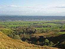
The hills between Kilbirnie and Largs were often black spots for aircraft passing over and many crashed due to low fog. The crash sites are available to visit, with wreckage still visible and some of these now form part of Clyde Muirshiel Regional Park.
Castles
Lying 2 miles (3 km) north of Kilbirnie on a promontory overlooking the wooded ravine of the River Garnock is Glengarnock Castle, a ruined 15th century keep. Ladyland Castle, mostly demolished, lay nearby and Ladyland House still survives as designed by David Hamilton.
Kilbirnie Loch
Kilbirnie Loch is 1 1⁄2 miles (2.4 km) long and nearly 1⁄2 mile (800 m) broad. Part of the area around the Loch is sliding possibly due to the old mining shafts under the area. A social centre built on the shores of the loch began to sink and had to be demolished.
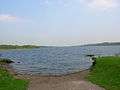 The loch in summer
 Looking towards Kilbirnie
 Kilbirnie Loch boat house
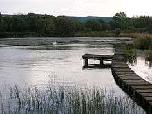 The south end of the loch
References
| Wikimedia Commons has media related to Kilbirnie. |
- GROS. "Scotland's Census 2011". Scotlandcensus.gov.uk. Retrieved 4 October 2014.
- Knight, James (1936), Glasgow and Strathclyde. London ; Thomas Nelson & Sons. pp. 83 - 84.
- "Glengarnock Primary School". Retrieved 12 March 2017.
- "School league tables: Breakdown of every Scottish school's performance". STV News. Retrieved 4 October 2014.
Bibliography
- Strawhorn, J. & Boyd, W. (1951) The third statistical account of Scotland: Ayrshire. Edinburgh: Oliver & Boyd.
- Wylie, William (1851). Ayrshire Streams. London : Arthur Hall, Virtue, & Co.
- "Un Hombre bueno, La Vida De Jaime Clifford" (AC Thomson)
External links
- Video and commentary - The Place, Walled Gardens, Grand Avenue, etc.
- Kilbirnie Community web site
- Kilbirnieauldkirk.org
- Ayrshireroots.com
- Scotlandspeople.gov.uk
- Kilbirnie Commercial site
- Plymouthbrethren.org
| Authority control |
|
|---|