Kilauea, Hawaii
Kilauea is an unincorporated community and census-designated place (CDP) in Kauaʻi County, Hawaii, United States. As of the 2010 census it had a population of 2,803.[1]
Kīlauea, Hawaii | |
|---|---|
 Location in Kauai County and the state of Hawaii | |
| Coordinates: 22.21°N 159.41°W | |
| Country | United States |
| State | Hawaii |
| County | Kauai |
| Area | |
| • Total | 5.3 sq mi (13.6 km2) |
| • Land | 4.9 sq mi (12.8 km2) |
| • Water | 0.3 sq mi (0.8 km2) |
| Elevation | 292 ft (89 m) |
| Population (2010) | |
| • Total | 2,803 |
| • Density | 566/sq mi (218.4/km2) |
| Time zone | UTC-10 (Hawaii-Aleutian) |
| ZIP codes | 96722, 96754 |
| Area code(s) | 808 |
| FIPS code | 15-36650 |
| GNIS feature ID | 0361214 |
Kīlauea shares the name of the active volcano Kilauea on the island of Hawaii. The name translates to "spewing" or "much spreading" in the Hawaiian language.[2]
The Guava Kai Plantation closed in late 2006/early 2007.[3]
Geography
Kilauea is on the northeastern shore of Kauai and is bordered to the west by Kalihiwai and to the north by the Pacific Ocean. Hawaii Route 56 passes through the south side of the community, leading west 7 miles (11 km) to Hawaii and east 6 miles (10 km) to the Moloaa area which includes Moloaa Forest Reserve and overlooks Moloaa Bay.
According to the U.S. Census Bureau, the Kilauea CDP has a total area of 5.3 square miles (13.6 km2), of which 4.9 square miles (12.8 km2) are land and 0.3 square miles (0.8 km2), or 5.71%, are water.[1]
References
- "Geographic Identifiers: 2010 Demographic Profile Data (G001): Kilauea CDP, Hawaii". American Factfinder. U.S. Census Bureau. Retrieved February 1, 2019.
- Pukui, Mary Kawena. Place Names of Hawaii. University of Hawaii Press. ISBN 0-8248-0524-0.
- "Archived copy". Archived from the original on 2011-03-18. Retrieved 2011-04-01.CS1 maint: archived copy as title (link)
Islands, municipalities, and communities of Kauai County, Hawaii, United States | ||
|---|---|---|
| CDPs | 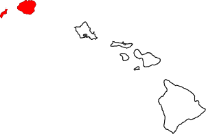 Map of Hawaii highlighting Kauai County | |
| Other communities | ||