Khar-Us Lake
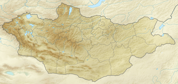
Khar-Us Lake (Mongolian:Хар-Ус нуур, lit. "black water lake") is a lake in western Mongolia in the Great Lakes Depression. It is the upper one in a system of the interconnected lakes: Khar-Us, Khar, Dörgön, Airag and Khyargas. The lake is located in Har Us Nuur National Park.
| Khar-Us Lake | |
|---|---|
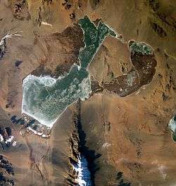 Khar-Us Lake frozen, Khar Lake fragment is at the western edge of the image, Jargalant-Khaikhan Mounts are south from Lake Khar-Us (NASA astronauts image 2002-12-13). | |
 Khar-Us Lake | |
| Location | Khovd aimag, Mongolia |
| Coordinates | 48°02′N 92°17′E |
| Type | freshwater |
| Primary inflows | Khovd River |
| Primary outflows | Chono Kharaikh gol |
| Catchment area | 74,500 km2 (28,800 sq mi) |
| Basin countries | Mongolia, Russia |
| Max. length | 72.2 km (44.9 mi) |
| Max. width | 36.5 km (22.7 mi) |
| Surface area | 1,578 km2 (609 sq mi) |
| Average depth | 2.2 m (7 ft 3 in) |
| Max. depth | 4.5 m (15 ft) |
| Water volume | 3.432 km3 (2,782,000 acre⋅ft) |
| Surface elevation | 1,156.7 m (3,795 ft) |
| Frozen | November - April |
| Islands | Agbash (Ak-Bashi) |
| Settlements | Dörgön |
| Designated | 13 April 1999 |
| Part of | Har Us Nuur National Park |
Its area value (1,852 km²) includes the island Agbash (or Ak-Bashi, white head) area (274 km²), so the water surface area is 1,578 km² only.[1]
Some sources are using different Khar-Us Lake Lake statistics values:[2]
- Water level: 1,160.08 m
- Surface area: 1,496.6 km²
- Average depth: 2.1 m
- Volume: 3.12 km³.
| Surface input | Surface output | Groundwater inflow- outflow |
Retention time, years | ||
|---|---|---|---|---|---|
| Precipitation | Inflow | Evaporation | Outflow | ||
| 56.4 | 1,979.2 | 942.7 | 675.3 | -417.6 | 1.1 |
Primary inflow is the Khovd River, which creates a large river delta.
So called Genghis Khan's wall runs along the western shore of the Khar-Us Lake. It is possible to find it at the Google Map and Google Earth satellite maps 47°53′29″N 91°59′37″E.
References
This article is issued from Wikipedia. The text is licensed under Creative Commons - Attribution - Sharealike. Additional terms may apply for the media files.