Hamar-Daban
Hamar-Daban (Russian: Хама́р-Даба́н; Buryat: Һамар дабаан, from hамар - "nut", and дабаан, "pass" or "ridge"), is a mountain range in Southern Siberia, Russia.
| Hamar-Daban | |
|---|---|
| Russian: Хама́р-Даба́н / Buryat: Һамар дабаан | |
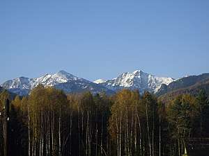 Landscape of the range | |
| Highest point | |
| Peak | Utulinskaya Podkova |
| Elevation | 2,396 m (7,861 ft) |
| Dimensions | |
| Length | 420 km (260 mi) E/W |
| Width | 65 km (40 mi) N/S |
| Geography | |
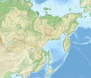 Location in the Buryatia, Far Eastern Federal District, Russia 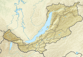 Hamar-Daban (Republic of Buryatia) | |
| Country | Russia |
| Federal subject | Buryatia and Irkutsk Oblast |
| Range coordinates | 51°25′N 104°30′E |
| Parent range | South Siberian System |
| Borders on | Eastern Sayan |
| Geology | |
| Type of rock | Slate, gneiss, basalt, limestone and granite intrusions |
| Climbing | |
| Easiest route | From Gusinoozyorsk |
Geography
The range is located in Buryatia, with a small section in Irkutsk Oblast. It rises near the Baikal Mountains not far from Lake Baikal. It forms a geographic prolongation of the Sayan Mountains.[1] The highest peak is Utulinskaya Podkova at 2,396 m (7,861 ft). The southern end of the range is part of the Selenga Highlands.[2]
The Khamar-Daban Range, near Kamensk.
References
- Kozhov, M. (2013-11-11). Lake Baikal and Its Life. Springer Science & Business Media. p. 7. ISBN 9789401573887.
- Natalʹi︠a︡ Vasilʹevna Fadeeva, Селенгинское среднегорье: природные условия и районирование (Selenga Highlands: Natural Conditions and Zoning) Buryat Book Publishing House, 1963 - Physical geography - 169 pages, (in Russian)
External links

This article is issued from Wikipedia. The text is licensed under Creative Commons - Attribution - Sharealike. Additional terms may apply for the media files.