Kete Krachi
Kete Krachi is a town in the Krachi West District of the Oti Region of Ghana. Kete Krachi is the capital of the Krachi West District. It is in the West of the Oti Region, and is adjacent to Lake Volta. Kete Krachi is connected by a ferry to the town of Kwadjokrom, and by road to Bimbila and Dambai. The town is also known for the Kete Krachi Secondary Technology.[2][3] The school is a second cycle institution.[4] Kete Krachi is the seventy-second most populous settlement in Ghana, in terms of population, with a population of 11,788 people.[1]
Kete Krachi Kete Kratje (former name) | |
|---|---|
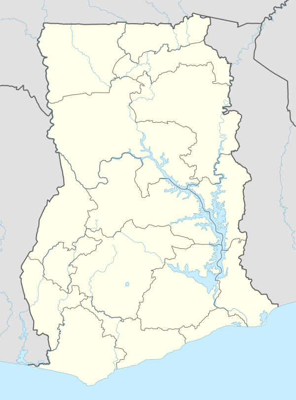 Kete Krachi Location of Kete Krachi in Oti Region | |
| Coordinates: 7°48′N 0°01′W | |
| Country | |
| Region | Oti |
| District | Krachi West District |
| Population (2013) | |
| • Total | 11,788[1] |
| Ranked 72nd in Ghana | |
| Time zone | GMT |
| • Summer (DST) | GMT |
Climate
| Climate data for Kete Krachi | |||||||||||||
|---|---|---|---|---|---|---|---|---|---|---|---|---|---|
| Month | Jan | Feb | Mar | Apr | May | Jun | Jul | Aug | Sep | Oct | Nov | Dec | Year |
| Record high °C (°F) | 38.3 (100.9) |
40.0 (104.0) |
40.6 (105.1) |
38.9 (102.0) |
37.2 (99.0) |
37.2 (99.0) |
33.3 (91.9) |
35.0 (95.0) |
33.9 (93.0) |
35.6 (96.1) |
36.7 (98.1) |
37.2 (99.0) |
40.6 (105.1) |
| Average high °C (°F) | 34.8 (94.6) |
36.7 (98.1) |
36.0 (96.8) |
34.8 (94.6) |
33.2 (91.8) |
30.8 (87.4) |
29.4 (84.9) |
29.6 (85.3) |
30.5 (86.9) |
32.2 (90.0) |
28.6 (83.5) |
30.6 (87.1) |
32.3 (90.1) |
| Daily mean °C (°F) | 23.2 (73.8) |
29.5 (85.1) |
29.9 (85.8) |
29.3 (84.7) |
28.2 (82.8) |
26.6 (79.9) |
25.7 (78.3) |
25.7 (78.3) |
26.2 (79.2) |
26.9 (80.4) |
25.0 (77.0) |
25.1 (77.2) |
26.8 (80.2) |
| Average low °C (°F) | 19.8 (67.6) |
22.4 (72.3) |
23.9 (75.0) |
23.8 (74.8) |
23.2 (73.8) |
22.5 (72.5) |
22.0 (71.6) |
21.8 (71.2) |
22.0 (71.6) |
21.7 (71.1) |
21.4 (70.5) |
19.6 (67.3) |
22.0 (71.6) |
| Record low °C (°F) | 11.5 (52.7) |
14.5 (58.1) |
20.5 (68.9) |
21.0 (69.8) |
20.0 (68.0) |
19.5 (67.1) |
17.0 (62.6) |
18.5 (65.3) |
19.5 (67.1) |
19.0 (66.2) |
16.0 (60.8) |
10.0 (50.0) |
10.0 (50.0) |
| Average precipitation mm (inches) | 24 (0.9) |
37 (1.5) |
86 (3.4) |
138 (5.4) |
229 (9.0) |
214 (8.4) |
205 (8.1) |
171 (6.7) |
276 (10.9) |
192 (7.6) |
188 (7.4) |
87 (3.4) |
1,847 (72.7) |
| Average precipitation days (≥ 0.3 mm) | 2 | 3 | 8 | 11 | 13 | 15 | 15 | 11 | 18 | 16 | 8 | 2 | 121 |
| Average relative humidity (%) (at 15:00) | 33 | 31 | 43 | 51 | 58 | 67 | 70 | 68 | 69 | 62 | 52 | 41 | 54 |
| Mean monthly sunshine hours | 223.2 | 228.8 | 244.9 | 225.0 | 248.0 | 180.0 | 139.5 | 155.0 | 135.0 | 229.4 | 264.0 | 254.2 | 2,527 |
| Mean daily sunshine hours | 7.2 | 8.1 | 7.9 | 7.5 | 8.0 | 6.0 | 4.5 | 5.0 | 4.5 | 7.4 | 8.8 | 8.2 | 6.9 |
| Source: Deutscher Wetterdienst[5] | |||||||||||||
References
- "World Gazetteer online". World-gazetteer.com. Archived from the original on 2012-01-11.
- "Educational Institutions". www.centralregion.gov.gh. Archived from the original on 1 August 2017. Retrieved 12 August 2011.
- "References » Schools/Colleges". www.modernghana.com. Retrieved 12 August 2011.
- "List of Secondary Schools in Ghana". www.ghanaschoolsnet.com/. Retrieved 12 August 2011.
- "Klimatafel von Kete–Krachi / Ghana" (PDF). Baseline climate means (1961-1990) from stations all over the world (in German). Deutscher Wetterdienst. Retrieved 18 October 2016.


This article is issued from Wikipedia. The text is licensed under Creative Commons - Attribution - Sharealike. Additional terms may apply for the media files.