Keli Lake
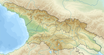
Keli Lake (Georgian: ყელის ტბა; Ossetian: Хъелы цад, Qely cad) is a volcanic-glacial lake[1] in the Akhalgori Municipality, Mtskheta-Mtianeti region of Georgia. located in Caucasus Mountains, in Keli Highland, at 2914 m above sea level.[2] Stuck between Kharuli and Alevi ranges. The area of surface is 1.28 km², while the catchment area is 7.8 km². Average depth is 24,7 m, maximal depth is 63 m. Gets its feed from snow, rainfall and underground waters. River Ksani outflows from the Lake.[3] Its water is clear.[2]
| Keli Lake | |
|---|---|
.jpg) Keli Lake | |
 Keli Lake 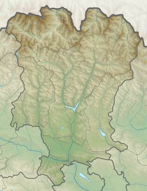 Keli Lake | |
| Coordinates | 42°28′47″N 44°18′54″E |
| Catchment area | 7.8 km2 (3.0 sq mi) |
| Basin countries | Georgia |
| Surface area | 1.28 km2 (0.49 sq mi) |
| Average depth | 24.7 m (81 ft) |
| Max. depth | 63 m (207 ft) |
| Water volume | 31.6 million cubic metres (1.12×10⁹ cu ft) |
| Surface elevation | 2,914 m (9,560 ft) |
References
- Levan Maruashvili, Physical Geography of Georgia, p. 64. Tbilisi, 1964.
- Georgian Soviet Encyclopedia, Ilia Apkhazava, V. 11, pp. 633-634, 1987.
- Озера Кельского нагорья, А. В. Зимницкий
| Wikimedia Commons has media related to Keli Lake. |
| Eastern Georgia |
| ||||
|---|---|---|---|---|---|
| Western Georgia |
| ||||
This article is issued from Wikipedia. The text is licensed under Creative Commons - Attribution - Sharealike. Additional terms may apply for the media files.