Kawkaban
Kawkaban (Arabic: كَوْكَبَان, romanized: Kawkabān) is a town located in Shibam Kawkaban District, Al Mahwit Governorate, Yemen. It contains a fortified citadel about 2,931 m (9,616 ft) above sea level.[1] The city is built upon a precipitous hilltop, walled from the north and fortified naturally from the other directions. It was the capital of the Yuʿfirids Muslim dynasty (847-997) and it was a capital of Bani Sharaf Al-Deen in the 9th 15th century. It was also home to a Jewish community, until its demise in the mid-20th century. The city affords a good prospect of the surrounding countryside.
Kawkaban كَوْكَبَان | |
|---|---|
Town | |
.jpg) .jpg) .jpg) .jpg) | |
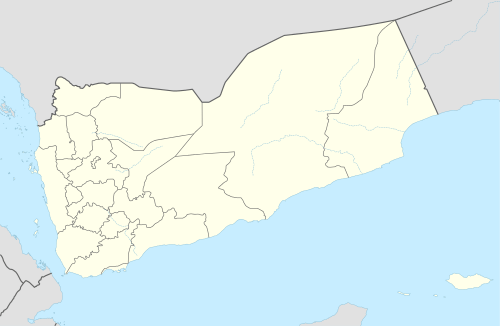 Kawkaban Location in Yemen | |
| Coordinates: 15°30′N 43°54′E | |
| Country | |
| Governorate | Al Mahwit Governorate |
| Time zone | UTC+3 (Yemen Standard Time) |
The city features several old mosques: al Madrasa, al Mansoor, al Sharefa and Harabat. The old market is located in the middle of the city. Old rainwater reservoirs can also be seen in the fortified town, named Meseda, Alasdad, and Sedalhamam.
History

The town is known as Shibam Kawkaban because it is located on a mountain called Kawkaban. It was also known as Shibam Yaḥbis, Shibam Ḥimyar and Shibam Aqyan. The Yuʿfirids Muslim dynasty (847-997) that emerged in the Yemen is originally from Shibam Kawkaban. Shibam Kawkaban became their capital.[2][3]
In the early 20th century, the mountain village was visited by German explorer and photographer, Hermann Burchardt, who wrote in May 1902: "Kawkaban, a now completely deserted town that still 40 years ago counted 30,000 inhabitants, but now hardly holds a few hundred; [it] also has its Jewish quarter, where still some families live."[4] Of the city's more popular citizens was the renowned Jewish poet, Zechariah Dhahiri.
On February 2016 as part of the Yemeni Civil War fighter jets from U.S.-backed, Saudi-led coalition struck the town citadel killing seven residents and destroying the historic gateway as well as the 700-year-old houses.[5]
Climate
.jpg)
Kawkaban has a distinct moderate semi-arid climate under the Köppen climate classification (BSh). Due to its outstanding elevation that nears 3,000 m (9,800 ft), the town receives larger diurnal ranges and more precipitation compared to the capital nearby Sanaa. The plentiful rainfall is a direct result to its exposed location (not shielded by any natural barriers) being on top of a mountain and its rugged terrain; both factors leading to occasional orographic lifts rising from nearby slopes.
| Climate data for Kawkaban | |||||||||||||
|---|---|---|---|---|---|---|---|---|---|---|---|---|---|
| Month | Jan | Feb | Mar | Apr | May | Jun | Jul | Aug | Sep | Oct | Nov | Dec | Year |
| Average high °C (°F) | 22.2 (72.0) |
23.3 (73.9) |
25.5 (77.9) |
26.3 (79.3) |
28.3 (82.9) |
30.0 (86.0) |
28.5 (83.3) |
27.2 (81.0) |
27.3 (81.1) |
26.2 (79.2) |
23.5 (74.3) |
22.2 (72.0) |
25.6 (78.1) |
| Daily mean °C (°F) | 14.0 (57.2) |
14.9 (58.8) |
17.3 (63.1) |
18.7 (65.7) |
20.6 (69.1) |
21.9 (71.4) |
22.1 (71.8) |
20.9 (69.6) |
20.2 (68.4) |
18.5 (65.3) |
16.3 (61.3) |
14.7 (58.5) |
18.3 (64.9) |
| Average low °C (°F) | 5.9 (42.6) |
6.5 (43.7) |
9.2 (48.6) |
11.1 (52.0) |
13.0 (55.4) |
13.8 (56.8) |
15.7 (60.3) |
14.7 (58.5) |
13.1 (55.6) |
10.9 (51.6) |
9.1 (48.4) |
7.2 (45.0) |
10.9 (51.6) |
| Average precipitation mm (inches) | 7 (0.3) |
8 (0.3) |
15 (0.6) |
38 (1.5) |
46 (1.8) |
17 (0.7) |
82 (3.2) |
112 (4.4) |
41 (1.6) |
8 (0.3) |
6 (0.2) |
1 (0.0) |
381 (14.9) |
| Source: Climate-Data.org[8] | |||||||||||||
See also
References
- Weather in Jabal Kawkabān Freemeteo. Retrieved on 11/08/2016.
- Smith, G. R. (2012-04-24). "Yuʿfirids". Encyclopaedia of Islam, Second Edition.
- زبارة, محمد بن محمد بن يحيى اليمني/الصنعاني (1998-01-01). نيل الوطر من تراجم رجال اليمن في القرن الثالث عشر 1-2 ج1 (in Arabic). Dar Al Kotob Al Ilmiyah دار الكتب العلمية. ISBN 978-2-7451-2623-8.
- Hermann Burchardt, Die Juden in Yemen, in: "Ost und West", Berlin 1902, p. 340.
- ‘Why is the world so quiet?’ Yemen suffers its own cruel losses, far from Aleppo.
- Robert D. Burrowes (2010). Historical Dictionary of Yemen. Rowman & Littlefield. pp. 5–340. ISBN 0-8108-5528-3.
- McLaughlin, Daniel (2008). "1: Background". Yemen. Bradt Travel Guides. p. 3. ISBN 978-1-8416-2212-5.
- "Climate: Kawkaban - Climate-Data.org". Retrieved 3 November 2017.
| 1,000,000 and more | |
|---|---|
| 100,000-999,999 | |
| 10,000-99,999 | |
| <9,999 | |
1Main Island become under control by United Arab Emirates since April 30, 2018 | |
Capital: Al Mahwit | |
| Districts | |