Kashmar
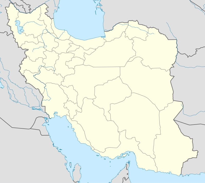
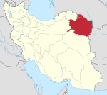
Kashmar (Persian: کاشمر, also Romanized as Kāshmar; formerly کشمر Keshmar, ترشیز Torshīz or سلطانآباد Soltanabad)[2] is a city and the capital of Kashmar County, in Razavi Khorasan Province, Iran. Cahitu is located near the river Sish Taraz in the western part of the province, and 217 kilometres (135 mi) south of the province's capital Mashhad, in Iran, from east to Bardaskan, west to Torbat-e Heydarieh, north to Nishapur, south to Gonabad. Until two centuries ago, this city was named Torshiz (ترشیز) and was the birthplace of Sheikh Ahmad-e Jami. At the 2006 census, its population was 81,527, in 21,947 families.[3]
Kashmar کاشمر | |
|---|---|
City | |
     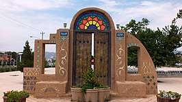 From up: Tomb of Hassan Modares, 2 photos Jameh Mosque of Kashmar, Imamzadeh Hamzeh, Kashmar, Imamzadeh Seyed Morteza, Old wooden door Symbol Kashmar. Kashmar Tourist Places | |
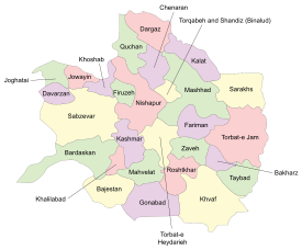 Razavi Khorasan counties | |
 Kashmar Razavi Khorasan counties | |
| Coordinates: 35°14′18″N 58°27′56″E | |
| Country | |
| Province | Razavi Khorasan |
| County | Kashmar |
| Bakhsh | Central |
| Elevation | 1,063 m (3,488 ft) |
| Population (2016 Census) | |
| • Urban | 102,282[1] |
| Time zone | UTC+3:30 (IRST) |
| • Summer (DST) | UTC+4:30 (IRDT) |
| Area code(s) | (+98) 051 552 |
| Kashmar at GEOnet Names Server | |
The city is fourth pilgrimage city in Iran And it is the second most pilgrimage city after Mashhad in Razavi Khorasan Province.[4]
There are four centers of higher education in this city, State University, Payame Nur University (a distant education system), Azad University of Kashmar, and Academic Center for Education, Culture and Research of Kashmar.
The city is a major producer of raisins and has about 40 types of grapes. It is also internationally recognized for exporting saffron and handmade Persian rugs.
History
The history of this city comes back to Zoroaster and Sarv-e Abarkuh, the Cypress of Kashmar (see also oldest tree). It seems that this is the single miracle of this prophet there are many fables about this.
Cypress of Kashmar
The Cypress of Kashmar is a mythical cypress tree of legendary beauty and gargantuan dimensions. It is said to have sprung from a branch brought by Zoroaster from Paradise and to have stood in today's Kashmar in northeastern Iran and to have been planted by Zoroaster in honor of the conversion of King Vishtaspa to Zoroastrianism. According to the Iranian physicist and historian Zakariya al-Qazwini King Vishtaspa had been a patron of Zoroaster who planted the tree himself. In his ʿAjā'ib al-makhlūqāt wa gharā'ib al-mawjūdāt, he further describes how the Al-Mutawakkil in 247 AH (861 AD) caused the mighty cypress to be felled, and then transported it across Iran, to be used for beams in his new palace at Samarra. Before, he wanted the tree to be reconstructed before his eyes. This was done in spite of protests by the Iranians, who offered a very high sum of money to save the tree. Al-Mutawakkil never saw the cypress, because he was murdered by a Turkish soldier (possibly in the employ of his son) on the night when it arrived on the banks of the Tigris.[5][6]
Souvenirs
The main souvenirs of this city are the Kashmar carpet, raisins, grapes, saffron, dried fruits, and the confectionary sohan.
Historical sites, ancient artifacts and tourism
- Tomb of Hassan Modarres
- Imamzadeh Seyed Morteza
- Imamzadeh Hamzeh, Kashmar
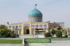
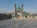
- Jameh Mosque of Kashmar
- Haji Jalal Mosque
- Atashgah castle
- Rig Castle
- Amin al-tojar Caravansarai
- Grave of Pir Quzhd
- Kohneh Zendeh Jan Castle
.jpg)
Notable people
- Alireza Faghani, born 21 March 1978 in Kashmar; an Iranian International football referee.
- Mohammad Khazaee, born 12 April 1953 in Kashmar; the former Ambassador of Iran to the United Nations.
- Sheikh Ahmad-e Jami (born Namagh (now Kashmar), Persia, 1048 – died Torbat-e Jam, 1141) a mystic and poet Persian.
- Manouchehr Eghbal 37th Prime Minister of Iran
Military operations
Climate
Köppen-Geiger climate classification system classifies its climate as cold semi-arid (BSk).[7]
| Climate data for Kashmar | |||||||||||||
|---|---|---|---|---|---|---|---|---|---|---|---|---|---|
| Month | Jan | Feb | Mar | Apr | May | Jun | Jul | Aug | Sep | Oct | Nov | Dec | Year |
| Average high °C (°F) | 9.5 (49.1) |
12.4 (54.3) |
16.8 (62.2) |
22.3 (72.1) |
29.2 (84.6) |
34 (93) |
35.7 (96.3) |
36.2 (97.2) |
31.9 (89.4) |
25.9 (78.6) |
18.1 (64.6) |
12 (54) |
23.7 (74.6) |
| Daily mean °C (°F) | 3.3 (37.9) |
6.1 (43.0) |
10.3 (50.5) |
15.3 (59.5) |
21.2 (70.2) |
25.6 (78.1) |
27.9 (82.2) |
27.4 (81.3) |
22.9 (73.2) |
17 (63) |
10.3 (50.5) |
5.3 (41.5) |
16.1 (60.9) |
| Average low °C (°F) | −2.9 (26.8) |
−0.1 (31.8) |
3.9 (39.0) |
8.4 (47.1) |
13.3 (55.9) |
17.3 (63.1) |
20.2 (68.4) |
18.6 (65.5) |
13.9 (57.0) |
8.2 (46.8) |
2.6 (36.7) |
−1.4 (29.5) |
8.5 (47.3) |
| Average precipitation mm (inches) | 29 (1.1) |
24 (0.9) |
31 (1.2) |
37 (1.5) |
17 (0.7) |
2 (0.1) |
0 (0) |
0 (0) |
0 (0) |
6 (0.2) |
13 (0.5) |
19 (0.7) |
178 (6.9) |
| Source: Climate-Data.org, altitude: 1057m[7] | |||||||||||||
Gallery
 Kohneh Zendeh Jan Castle
 Rig Castle
 Amin al-tojar Caravansarai
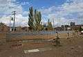 Grave of Pir Quzhd
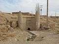 Ghanat
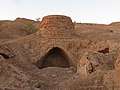 Watermill of Talaabad
 Kashmar Enghelab sport complex
 Kashmar Enghelab sport complex
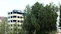 Tree in Kudak park
.JPG) Azadegan Digital telephone center
Azadegan Digital telephone center Traffic police booth
_(2).JPG) Shohada' Square
Shohada' Square
References
- https://www.amar.org.ir/english
- Kashmar can be found at GEOnet Names Server, at this link, by opening the Advanced Search box, entering "-3069992" in the "Unique Feature Id" form, and clicking on "Search Database".
- "Census of the Islamic Republic of Iran, 1385 (2006)". Islamic Republic of Iran. Archived from the original (Excel) on 2011-11-11.
- "دومین شهر زیارتی خراسان رضوی". khorasan.iqna.ir. Retrieved 6 February 2020.
- "The Destruction of Sacred Trees". www.goldenassay.com. Retrieved 6 February 2020.
- "The Cypress of Kashmar and Zoroaster". www.zoroastrian.org.uk. Retrieved 6 February 2020.
- "Climate: Kashmar - Climate graph, Temperature graph, Climate table". Climate-Data.org. Retrieved 17 September 2013.
External links
| Wikimedia Commons has media related to Kashmar. |
| Wikivoyage has a travel guide for Kashmar. |
| Capital | |||||||||||||||||||||
|---|---|---|---|---|---|---|---|---|---|---|---|---|---|---|---|---|---|---|---|---|---|
| Districts |
| ||||||||||||||||||||
| Authority control |
|
|---|