Kaptai Lake
Kaptai Lake is the largest lake in Bangladesh.[1] It is located in the Kaptai Upazila under Rangamati District of Chittagong Division. The lake was created as a result of building the Kaptai Dam on the Karnaphuli River, as part of the Karnaphuli Hydro-electric project. The Kaptai Lake's average depth is 100 feet (30 m) and maximum depth is 490 feet (150 m).
| Kaptai Lake | |
|---|---|
 | |
| Location | South-Eastern Bangladesh |
| Coordinates | 22°29′45″N 92°13′45″E |
| Type | reservoir |
| Primary inflows | Karnaphuli River |
| Primary outflows | Karnaphuli River |
| Catchment area | 11,122 km2 (4,294 sq mi) |
| Basin countries | Bangladesh |
| Average depth | 100 ft (30 m) |
| Max. depth | 495 ft (151 m) |
History
Construction of the reservoir for the hydro-electric plant began in 1956 by the Government of East Pakistan.[2] As a result, 54,000 acres (220 km2) of farmland in the Rangamati District went under water and created the lake. The hydro-electric project was funded by the United States. The project was finished in 1962. International Engineering Company and Utah International Inc. received the contract for construction of the dam. The dam is 670.8 meters long, and 54.7 meters high. The dam has a 745 feet (227 m) long spillway containing 16 gates. Through the spillway 5,250,000 cu ft/s (149,000 m3/s) of water can pass.
The land that went under water as a result of the dam construction, was 40% of the total arable land in the area. Along with that, 29 square miles (75 km2) of the Government-owned forest, and 234 square miles (610 km2) of other forest land went under water. About 18,000 families with a total of almost 100 thousand people were also displaced. The palace of the king of the Chakmas was also flooded and is now under water.[2]
Gallery
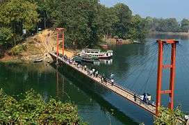 Hanging Bridge
 the lake
 Sunset on the lake
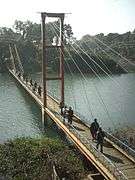 Bridge over the lake
 Boat on the lake
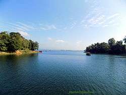
 View of Kaptai lake, Rangamati
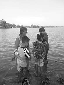
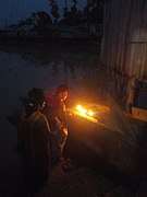 Prayer at Kaptai Lake
See also
- Mahamaya irrigation project
- Kaptai National Park
References
- "Kaptai Lake - Banglapedia". en.banglapedia.org. Retrieved 2016-04-16.
- Daily JaiJaiDin, January 10, 2008. Page 10.