Kagarko
Kagarko is a Local Government Area in Kaduna State, Nigeria. Its headquarters are in the town of Kagarko.
Kagarko | |
|---|---|
LGA and town | |
| Nickname(s): Garmin Bubu | |
 Kagarko Location in Nigeria | |
| Coordinates: 9°27′0″N 7°41′0″E | |
| Country | |
| State | Kaduna State |
| Government | |
| • Local Government Chairman | Nasara Rabo |
| Time zone | UTC+1 (WAT) |
| Website | www.kagarkolocalgovernment.com |
It has an area of 1,864 km² and a population of 240,943 at the 2006 census .It comprises about eleven districts which are Shadalafiya, Katugal, Kushe, Jere, Dogon Kurmi, Kenyi, Kurmin Dangana, Kubacha,Aribi and Kagarko districts. and has ten political wards which includes Kagarko North, Kagarko South, Jere North, Jere South, Aribi, Kushe, Kukui, Iddah, Katugal and Kurmin Jibrin. The people are predominantly Koro and Hausa are two of the major tribe and Gbagyi. They are very hard working and mostly farmers, about 70% of ginger produced in Kaduna State is from Kagarko.
The postal code of the area is 802.[1]
References
- "Post Offices- with map of LGA". NIPOST. Archived from the original on 2009-10-07. Retrieved 2009-10-20.
State capital: Kaduna | ||
| Local Government Areas | 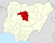 | |
This article is issued from Wikipedia. The text is licensed under Creative Commons - Attribution - Sharealike. Additional terms may apply for the media files.