Kafr Nabudah
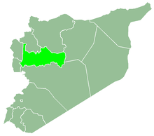
Kafr Nabudah (Arabic: كفر نبودة, also spelled Kafar Nabuda) is a town in northern Syria, administratively part of the Hama Governorate, located northwest of Hama. Nearby localities include Qalaat al-Madiq and Jamasat Udayat to the west, al-Suqaylabiyah to the southwest, al-Mughayr and Karnaz to the south, Kafr Zita to the southeast and al-Habit to the east. According to the Syria Central Bureau of Statistics (CBS), Kafr Nabudah had a population of 13,513 in the 2004 census, making it the largest locality in the Qalaat al-Madiq nahiyah ("subdistrict.")[1]
Kafr Nabudah كفر نبودة Kafar Nabuda | |
|---|---|
Town | |
 Kafr Nabudah Location in Syria | |
| Coordinates: 35°25′54″N 36°29′34″E | |
| Country | |
| Governorate | Hama |
| District | Al-Suqaylabiyah |
| Subdistrict | Qalaat al-Madiq |
| Population (2004) | |
| • Total | 13,513 |
| • Ethnicities | Syrians |
History
In 2011, a mosaic was discovered in Kafr Nabudah dates back to the 6th century during the Byzantine era.[2] During the Syrian Civil War, the Syrian army re-controlled the town during the Northwestern Syria offensive in 2019.
References
- General Census of Population and Housing 2004. Syria Central Bureau of Statistics (CBS). Hama Governorate. (in Arabic)
- "اكتشاف لوحة فسيفساء في حماة السورية تعود إلى القرن السادس الميلادي". aleqt.com (in Arabic). 7 January 2011.