Kach, Pakistan
Kach is town and union council of the Ziarat District in the Balochistan province of Pakistan.[1] It is located at 30°26'2N 67°19'27E and has an altitude of 2020m (6630ft).[2]
Kach | |
|---|---|
 Kach | |
| Coordinates: 30.26°N 67.19°E | |
| Country | |
| Province | Balochistan |
| Elevation | 2,020 m (6,630 ft) |
| Time zone | UTC+5 (PST) |
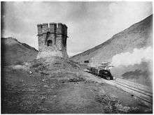
Kach Station and blockhouse near the divide between Harnai and Quetta 1895
References
This article is issued from Wikipedia. The text is licensed under Creative Commons - Attribution - Sharealike. Additional terms may apply for the media files.