Kaçkar Mountains
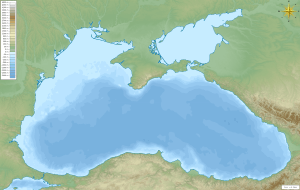
Kaçkar Mountains (Armenian: Խաչքարի լեռներ; Turkish: Kaçkar Dağları) or simply Kaçkars (Turkish: Kaçkarlar), formerly known as Lazistan Mountains[1][2] are a mountain range that rises above the Black Sea coast in eastern Turkey.
| Kaçkar Mountains | |
|---|---|
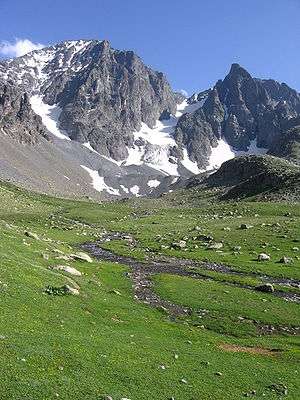 The highest peak Kaçkar Dağı from Mezovit Çayiri | |
| Highest point | |
| Peak | Kaçkar Dağı |
| Elevation | 3,937 m (12,917 ft) |
| Dimensions | |
| Length | 1,000 km (620 mi) |
| Geography | |
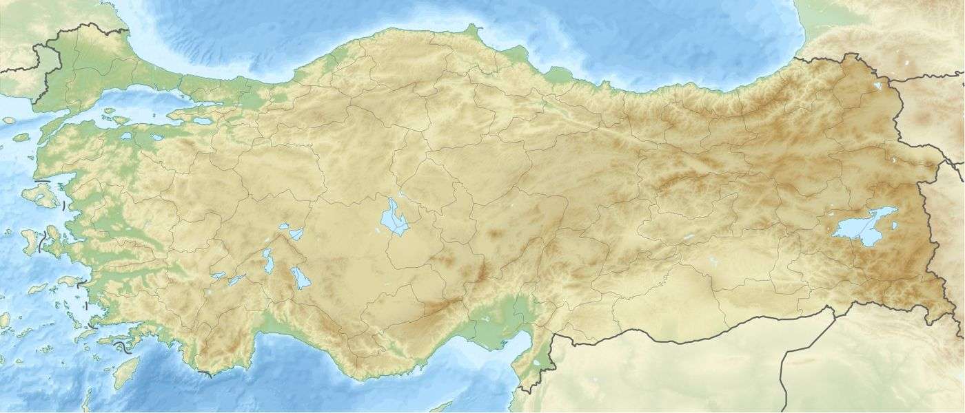  | |
| Country | Turkey |
| Range coordinates | 40°50′N 41°9′E |
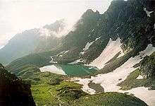
With highest peak Kaçkar Dağı at an elevation of 3,937 metres (12,917 ft), and mountain plateaus at about 3,000 m (9,800 ft) in elevation, it is the highest part of the Pontic Mountains. The Kaçkars are glaciated mountains that are alpine in character, with steep rocky peaks and numerous mountain lakes. The area was declared a national park in 1994. Tourism activities in the park include hiking, camping, mountaineering, and, increasingly, heliskiing. [3] [4]
Geography and etymology
The name Kaçkar (from Armenian khachkar (Խաչքար)[5] literally meaning "cross stone"[6]) may be used in various senses. It may describe the whole mountain range, including the many mountain groups, or it may just describe the Kaçkar-Kavron group with its highest peak, or just the highest peak itself. The local name of the highest peak or its mountain group Kaçkar Dağı translates to Kaçkar Mountain, and the name of the range Kaçkar Dağları translates to Kaçkar Mountains.
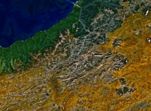
On the south and east, the Kaçkar Mountains are bordered by the Çoruh river valley; on the north, by the Black Sea coast.
Major mountain groups
- Altıparmak group
- Kavron (or Kaçkar-Kavron)
- Verçenik group
Trekking
Kackar Mountains are one of the best trekking sites in Turkey. Kackars have two ideal trekking routes. The first is from the Black Sea side; the path is clear and it is easy to trek, while the Coruh side is more difficult and hazardous. Kackar Mountains are cold and have glaciers, hence ice axes and crampons are required. The best time for trekking is between June and September.[7]
See also
References
- Knight, Charles (1854). English cyclopaedia, a new dictionary of universal knowledge, conducted by Charles Knight. London: Bradbury. doi:10.5962/bhl.title.18631.
- Somerville, Mary, 1780-1872. (1870). Physical geography. J. Murray. OCLC 24192172.CS1 maint: multiple names: authors list (link)
- "Mt. Kackar to be monitored". Turkish Daily News. (National ed.). Ankara. 31 October 2007. p. 1. Retrieved 11 October 2009.
- Hadik, Jancsi (1 November 2005). "First Tracks". Skiing. Winter Park, Florida: Bonnier Corporation. 58 (3): 28. ISSN 0037-6264. Retrieved 11 October 2009.
- Marc Dubin; Enver Lucas (1989). Trekking in Turkey. Lonely Planet. p. 125. ISBN 0-86442-037-4.
- Robert H. Hewsen. Armenia: A Historical Atlas. — University of Chicago Press, 2001. — 341 p. — ISBN 0-226-33228-4, ISBN 978-0-226-33228-4. P.212. "River between the port of Atina (now Pazar) on the coast and the great inland peak called Kajkar (Arm. Khach'k'ar) Dagh 'Cross-stone Mountain'"
- Kackar Mountains Turkey
- Tunç Fındık (2001) Kaçkar Dağları, Homer Kitabevi, Istanbul. ISBN 975-8293-18-4 (in Turkish)
External links
- Photos of Kaçkar Mountains
- Kackar hiking Trip report of a backpacking trip in the Kackar Mountains.
- Kaçkar Kültür ve Dayanışma Derneğinden Kaçkar dağlarının fotoğrafları
- Hiking and Climbing Routes, GPS sources
- Kaçkar Pansiyon