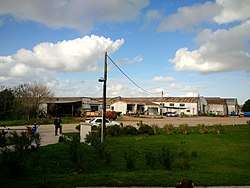
José Pedro Varela, Uruguay
José Pedro Varela is a small city in the north of Lavalleja Department of southeastern Uruguay. It is named after the sociologist and politician José Pedro Varela.
José Pedro Varela | |
|---|---|
City | |
 | |
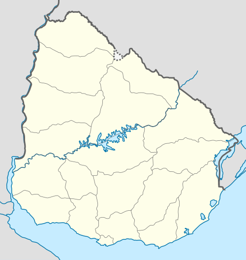 José Pedro Varela Location in Uruguay | |
| Coordinates: 33°27′0″S 54°32′0″W | |
| Country | |
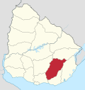
| Department | |
| Population (2011 Census) | |
| • Total | 5,118 |
| Time zone | UTC -3 |
| Postal code | 30300 |
| Dial plan | +598 4455 (+4 digits) |
Location
The city is located on Route 8 and the banks of Arroyo Corrales, which is the border with Treinta y Tres Department, about 27 kilometres (17 mi) south of the city of Treinta y Tres and 135 kilometres (84 mi) northeast of the department capital Minas.
History
A populated centre was founded here on 24 August 1898.[1] On 1 February 1918, its status was elevated to "Pueblo" (village) by decree Ley N° 5.639 and on 16 October 1958 to "Villa" (town) by decree N° 12.553[2] It received the status of "Ciudad" (city) on 19 November 1967 by decree Ley Nº 13.631.[3]
Population
In 2011, José Pedro Varela had a population of 5,118.[4]
| Year | Population |
|---|---|
| 1908 | 1,200 |
| 1963 | 2,982 |
| 1975 | 3,543 |
| 1985 | 4,077 |
| 1996 | 4,983 |
| 2004 | 5,332 |
| 2011 | 5,118 |
Source: Instituto Nacional de Estadística de Uruguay[1]
Places of worship
- St. Charles Borromeo Parish Church (Roman Catholic)
References
- "Statistics of urban localities (1908–2004)" (PDF). INE. 2012. Archived from the original (PDF) on 13 November 2009. Retrieved 4 September 2012.
- "Ley Nº 12.553". República Oriental del Uruguay, Poder Legislativo. 1958. Archived from the original on 4 March 2016. Retrieved 4 September 2012.
- "LEY N° 13.631". República Oriental del Uruguay, Poder Legislativo. 1967. Archived from the original on 2 April 2015. Retrieved 4 September 2012.
- "Censos 2011 Cuadros Lavalleja". INE. 2012. Archived from the original on 10 October 2012. Retrieved 25 August 2012.
External links
Capital: Minas | ||
| Towns and villages |
|  |
| Sights | ||