Jordan, Minnesota
Jordan is a city in Scott County, Minnesota, United States. The population was 5,470 at the 2010 census.[5]
Jordan | |
|---|---|
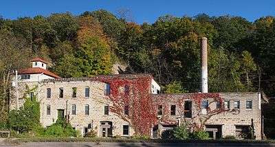
 Old City Hall | |
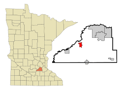 Location of the city of Jordan within Scott County, Minnesota | |
| Coordinates: 44°40′6″N 93°37′57″W | |
| Country | United States |
| State | Minnesota |
| County | Scott |
| Founded | 1853 |
| Established | 1872 |
| Incorporated | 1891 |
| Government | |
| • Mayor | Tanya Velishek |
| Area | |
| • Total | 3.21 sq mi (8.32 km2) |
| • Land | 3.19 sq mi (8.26 km2) |
| • Water | 0.02 sq mi (0.06 km2) |
| Elevation | 771 ft (235 m) |
| Population | |
| • Total | 5,470 |
| • Estimate (2018)[3] | 6,276 |
| • Density | 1,960.20/sq mi (756.89/km2) |
| Time zone | UTC-6 (Central (CST)) |
| • Summer (DST) | UTC-5 (CDT) |
| ZIP code | 55352 |
| Area code(s) | 952 |
| FIPS code | 27-32174 |
| GNIS feature ID | 0645735[4] |
| Website | City of Jordan |
History
The city of Jordan began on November 27, 1853, when Thomas A. Holmes ordered the construction of a sawmill. This establishment gave Jordan its first name, Holmes Mill.[6]
A year after the mill's founding, Thomas's brother William Holmes moved to the site and began platting a settlement.[7] By 1855, he successfully surveyed and recorded his settlement as Jordan City, after the Jordan River in Palestine.[8] Jordan City accumulated some success in 1855 and 1856 with the addition of a post office and a handful of a businesses.
In 1860, the neighboring settlement of Brentwood was surveyed by S. A. Hooper, J. H. Gardner and R. W. Thomas. The two settlements competed until a legislative action consolidated them into the village of Jordan in 1872. The consolidation only helped the settlement and by 1880 the population had boomed to 915 along with a boom in businesses in the village. A few of these businesses were breweries, which became especially successful until prohibition in 1919 temporarily caused their closure.
Jordan was finally incorporated as a city in 1891.[7][9][10]
Geography
According to the United States Census Bureau, the city has a total area of 3.31 square miles (8.57 km2); 3.29 square miles (8.52 km2) is land and 0.02 square miles (0.05 km2) is water.[11]
U.S. Highway 169, and State Highways 21 and 282 are three of the main routes in the community.
The architects and civil engineers known for designing the layout of the streets of Jordan, also founded the neighboring town of Belle Plaine.
Demographics
| Historical population | |||
|---|---|---|---|
| Census | Pop. | %± | |
| 1880 | 915 | — | |
| 1890 | 1,233 | 34.8% | |
| 1900 | 1,270 | 3.0% | |
| 1910 | 1,151 | −9.4% | |
| 1920 | 1,106 | −3.9% | |
| 1930 | 1,119 | 1.2% | |
| 1940 | 1,422 | 27.1% | |
| 1950 | 1,494 | 5.1% | |
| 1960 | 1,479 | −1.0% | |
| 1970 | 1,836 | 24.1% | |
| 1980 | 2,663 | 45.0% | |
| 1990 | 2,909 | 9.2% | |
| 2000 | 3,833 | 31.8% | |
| 2010 | 5,470 | 42.7% | |
| Est. 2018 | 6,276 | [3] | 14.7% |
| U.S. Decennial Census[12] 2013 Estimate[13] | |||
2010 census
As of the census[2] of 2010, there were 5,470 people, 1,871 households, and 1,428 families living in the city. The population density was 1,662.6 inhabitants per square mile (641.9/km2). There were 1,961 housing units at an average density of 596.0 per square mile (230.1/km2). The racial makeup of the city was 92.4% White, 0.6% African American, 0.8% Native American, 1.3% Asian, 2.4% from other races, and 2.4% from two or more races. Hispanic or Latino of any race were 6.5% of the population.
There were 1,871 households of which 48.5% had children under the age of 18 living with them, 59.9% were married couples living together, 9.8% had a female householder with no husband present, 6.6% had a male householder with no wife present, and 23.7% were non-families. 18.4% of all households were made up of individuals and 6.5% had someone living alone who was 65 years of age or older. The average household size was 2.92 and the average family size was 3.35.
The median age in the city was 31.8 years. 34% of residents were under the age of 18; 6.1% were between the ages of 18 and 24; 32.9% were from 25 to 44; 20.8% were from 45 to 64; and 6.1% were 65 years of age or older. The gender makeup of the city was 50.0% male and 50.0% female.
2000 census
As of the census of 2000, there were 3,833 people, 1,349 households, and 980 families living in the city. The population density was 1,466.5 people per square mile (567.0/km²). There were 1,423 housing units at an average density of 544.4 per square mile (210.5/km²). The racial makeup of the city was 94.08% White, 0.50% African American, 0.60% Native American, 0.18% Asian, 3.10% from other races, and 1.54% from two or more races. Hispanic or Latino of any race were 6.60% of the population.
Recreation
Jordan has a tradition of baseball.
Jordan is home to the Jordan Brewers amateur baseball team, state champions in 1986, 1994, 2004, and 2019. Brewer Tournament MVPs include: Ron Beckman (1986), John Dolan (1994), Trent Bohnsack (2004) and Joe Lucas (2019).
Jordan is also home to the Post #3 Jordan Legion Baseball Team, which won the State Tournament four straight years from 2005 to 2008. It took 2nd place in 2010 and 3rd place in 2004 and 2009. It won the National/Regional Tournament three straight years from 2005 to 2007 and was runner-up in 2008.
Jordan High School athletic teams have different mascots for men (Hubmen), women (Jaguars) and cooperative sports (Panthers) with neighboring Belle Plaine. Jordan's High School football team won the Minnesota State championship in 1983.[14]
City parks
- Brentwood Park
- Pekarna Park
- Lions Park
- Log Cabin
- Lagoon Park
- Timberline Park
- Holzer Park
- Jordan Skateboard Park (designed by Jared Hunt and John Beckius)
- Mini-Met Ball Park (directly adjacent to the Skateboard Park)
State parks and reserves
- Metropolitan Regional Park System
- Minnesota Valley National Wildlife Refuge
- Minnesota Valley State Recreation Area
Places to worship
- Hope Lutheran Church
- Sand Creek Baptist Church
- St. Paul's Lutheran Church
- Tree of Life Church
- St. John's Catholic Church
In the media
In 1985, several adults in Scott County were accused of sexual abuse of children, although only one, James Rud, was convicted. (See Report on Scott County Investigations, Hubert H. Humphrey III, Attorney General (Feb. 12, 1985).[15] The case was the subject of the song titled "Jordan, Minnesota", by Chicago-based noise rock band Big Black, which appears on the 1986 album Atomizer.[16]
References
- "2017 U.S. Gazetteer Files". United States Census Bureau. Retrieved Jan 3, 2019.
- "U.S. Census website". United States Census Bureau. Retrieved 2012-11-13.
- "Population and Housing Unit Estimates". Retrieved September 14, 2019.
- "US Board on Geographic Names". United States Geological Survey. 2007-10-25. Retrieved 2008-01-31.
- "2010 Census Redistricting Data (Public Law 94-171) Summary File". American FactFinder. United States Census Bureau. Retrieved 27 April 2011.
- https://sjbjordan.org/parish-history
- Upham, Warren (1920). Minnesota Geographic Names: Their Origin and Historic Significance. Minnesota Historical Society. p. 508.
- Chicago and North Western Railway Company (1908). A History of the Origin of the Place Names Connected with the Chicago & North Western and Chicago, St. Paul, Minneapolis & Omaha Railways. p. 180.
- http://twincitiespropertyfinder.com/city-of-jordan-a-brief-history/
- http://www.explorejordanmn.com/about-jordan/
- "US Gazetteer files 2010". United States Census Bureau. Archived from the original on 2012-07-02. Retrieved 2012-11-13.
- United States Census Bureau. "Census of Population and Housing". Retrieved February 12, 2014.
- "Population Estimates". United States Census Bureau. Archived from the original on 2014-05-22. Retrieved 2014-11-21.
- "State Champions". MN Football Hub. Retrieved 2017-10-23.
- [Child Sexual Abuse: The Scott County Investigation] Accessed 6th February 2010 "Archived copy". Archived from the original on October 13, 2009. Retrieved 2013-05-31.CS1 maint: archived copy as title (link) CS1 maint: BOT: original-url status unknown (link)
- Jordan, Minnesota Archived 2010-01-21 at the Wayback Machine Accessed 6th February 2010
External links
- City of Jordan Official Website official site
- Shakopee newspaper site
- Jordan Independent newspaper site
- Explore Jordan Jordan Minnesota site
- Nicolin Mansion Bed & Breakfast site
- 225 Water Street Creative Arts historic walking tour site
- Jordan Brewers Baseball baseball site
Municipalities and communities of Scott County, Minnesota, United States | ||
|---|---|---|
| Cities | 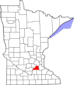 Map of Minnesota highlighting Scott County | |
| Townships | ||
| Unincorporated communities | ||
| Ghost towns/Neighborhoods | ||
| Indian reservation | ||
| Footnotes | ‡This populated place also has portions in an adjacent county or counties | |