Jasenica (village)
Jasenica (Hungarian: Jeszence) is a village and municipality in Považská Bystrica District in the Trenčín Region of north-western Slovakia.
Jasenica | |
|---|---|
Municipality | |
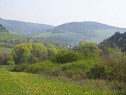 View on the valley where Jasenica lies | |
 Coat of arms | |
 Jasenica Location of Jasenica in the Trenčín Region 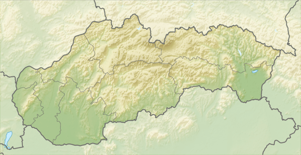 Jasenica Jasenica (Slovakia) | |
| Coordinates: 49°10′47″N 18°27′00″E | |
| Country | Slovakia |
| Region | Trenčín |
| District | Považská Bystrica |
| First mentioned | 1269 |
| Area | |
| • Total | 7.298 km2 (2.818 sq mi) |
| Elevation | 311 m (1,020 ft) |
| Population | |
| • Total | 1,030 |
| • Density | 140/km2 (370/sq mi) |
| Postal code | 018 17 |
| Area code(s) | 421-42 |
| Car plate | PB |
| Website | www.jasenica.sk |
History
In historical records the village was first mentioned in 1269.
Geography
Jasenica is lying in Považie region in Papradno valley among four hills Hradište, Dúbrava, Súdna and Lopušná. Across this valley flows river called Papradnianka. The municipality lies at an altitude of 311 metres and covers an area of 7.298 km². It has a population of about 1030 peoples.
Religion
In village is Roman Catholic parish of St. Michael Archangel where two next village belong: Stupné and Podvažie. Parish church is Church of St. Michael Archangel in Jasenica.
Genealogical resources
The records for genealogical research are available at the state archive "Statny Archiv in Bytca, Slovakia"
- Roman Catholic church records (births/marriages/deaths): 1717-1895 (parish A)
External links
![]()
- Official website

- http://travelingluck.com/Europe/Slovakia/Slovakia+(general)/_3059703_Jasenica.html#themap - Maps of Jasenica, weather in Jasenica, sunrise and sunset in Jasenica
- https://web.archive.org/web/20071027094149/http://www.statistics.sk/mosmis/eng/run.html
- http://www.travelsradiate.com/europe/slovak-republic/Jasenica/3059703-Jasenica.html
- Surnames of living people in Jasenica
Municipalities of Považská Bystrica District | ||
|---|---|---|