Jajigram
Jajigram (also referred to as Sripat Jajigram) is a village in Katwa I CD block in Katwa subdivision of Purba Bardhaman district in the Indian state of West Bengal.
Jajigram | |
|---|---|
Village | |
 Jajigram Location in West Bengal, India  Jajigram Jajigram (India) | |
| Coordinates: 23.6301°N 88.1036°E | |
| Country | |
| State | West Bengal |
| District | Purba Bardhaman |
| Population (2011) | |
| • Total | 4,471 |
| Languages | |
| • Official | Bengali, English |
| Time zone | UTC+5:30 (IST) |
| Lok Sabha constituency | Bardhaman Purba |
| Vidhan Sabha constituency | Katwa |
| Website | purbabardhaman |
Geography
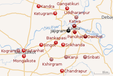 |
| Cities and towns in the Katwa subdivision of Purba Bardhaman district M: municipal city/ town, CT: census town, R: rural/ urban centre, H: historical place/ religious and/ or cultural centre, C: craft centre. Owing to space constraints in the small map, the actual locations in a larger map may vary slightly |
Location
Jajigram is located at 23.6301°N 88.1036°E.
Urbanisation
88.44% of the population of Katwa subdivision live in the rural areas. Only 11.56% of the population live in the urban areas.[1] The map alongside presents some of the notable locations in the subdivision. All places marked in the map are linked in the larger full screen map.
Demographics
As per the 2011 Census of India, Jajigram had a total population of 4,471 of which 2,287 (51%) were males and 2,184 (49%) were females. Population below 6 years was 593. The total number of literates in Jajigram was 2,601 (67.07% of the population over 6 years).[2]
Transport
Jajigram is at the junction of State Highway 14 and State Highway 6.[3]
Education
Bengal Institute of Technology, Katwa is a polytechnic college at Jajigram.[4]
Culture
Srinivasa Acarya is believed to have lived at Jajigram and his relics can still be seen at Sadhanpith.[5]
References
- "District Statistical Handbook 2014 Bardhaman". Table 2.2. Department of Statistics and Programme Implementation, Government of West Bengal. Retrieved 25 January 2019.
- "C.D. Block Wise Primary Census Abstract Data(PCA)". 2011 census: West Bengal – District-wise CD Blocks. Registrar General and Census Commissioner, India. Retrieved 18 February 2019.
- Google maps
- "Bengal Institute of Technology, Katwa". StudyGuideIndia.com. Retrieved 18 February 2019.
- "Purba Bardhaman district". Tourism. District Administration. Retrieved 18 February 2019.
Cities, towns and locations in Purba Bardhaman district, West Bengal | |||||||||
|---|---|---|---|---|---|---|---|---|---|
| Cities, municipal and census towns |
| ||||||||
| Locations other than cities and towns |
| ||||||||
| Related topics |
| ||||||||