Jackson Township, Preble County, Ohio
Jackson Township is one of the twelve townships of Preble County, Ohio, United States. The 2000 census found 1,223 people within the township. The Jackson community is served by National Trail High School and the National Trail Local School District. Interstate 70 runs along the northern part of the township.[3]
Jackson Township, Preble County, Ohio | |
|---|---|
 Fields on Toby Road | |
 Location of Jackson Township in Preble County | |
| Coordinates: 39°47′18″N 84°45′34″W | |
| Country | United States |
| State | Ohio |
| County | Preble |
| Area | |
| • Total | 34.4 sq mi (89.1 km2) |
| • Land | 34.4 sq mi (89.1 km2) |
| • Water | 0.0 sq mi (0.0 km2) |
| Elevation | 1,161 ft (354 m) |
| Population (2000) | |
| • Total | 1,223 |
| • Density | 35.5/sq mi (13.7/km2) |
| Time zone | UTC-5 (Eastern (EST)) |
| • Summer (DST) | UTC-4 (EDT) |
| FIPS code | 39-38010[2] |
| GNIS feature ID | 1086850[1] |
Geography
Located in the northwestern part of the county, it borders the following townships:
- Jefferson Township - north
- Monroe Township - northeast corner
- Washington Township - east
- Dixon Township - south
- Boston Township, Wayne County, Indiana - southwest
- Wayne Township, Wayne County, Indiana - northwest
No municipalities are located in Jackson Township.
Name and history
Jackson Township was founded in 1816,[4] and named for General Andrew Jackson, afterward seventh President of the United States.[5] It is one of thirty-seven Jackson Townships statewide.[6]
Government
The township is governed by a three-member board of trustees, who are elected in November of odd-numbered years to a four-year term beginning on the following January 1. Two are elected in the year after the presidential election and one is elected in the year before it. There is also an elected township fiscal officer,[7] who serves a four-year term beginning on April 1 of the year after the election, which is held in November of the year before the presidential election. Vacancies in the fiscal officership or on the board of trustees are filled by the remaining trustees.
References
- "US Board on Geographic Names". United States Geological Survey. 2007-10-25. Retrieved 2008-01-31.
- "U.S. Census website". United States Census Bureau. Retrieved 2008-01-31.
- Preble County, Ohio — Population by Places Estimates Ohio State University, 2007. Accessed 15 May 2007.
- Kilbourn, John (1833). The Ohio Gazetteer, or, a Topographical Dictionary. Scott and Wright. pp. 250. Retrieved 12 December 2013.
- History of Preble County, Ohio, with illustrations and biographical sketches. H. Z. Williams & Bro. 1881. p. 37.
- "Detailed map of Ohio" (PDF). United States Census Bureau. 2000. Retrieved 2007-02-16.
- §503.24, §505.01, and §507.01 of the Ohio Revised Code. Accessed 4/30/2009.
External links
Municipalities and communities of Preble County, Ohio, United States | ||
|---|---|---|
| City | 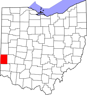 Map of Ohio highlighting Preble County | |
| Villages | ||
| Townships | ||
| CDP | ||
| Unincorporated communities | ||
| Ghost towns | ||
| Footnotes | ‡This populated place also has portions in an adjacent county or counties | |