Ixonia, Wisconsin
Ixonia is a town in Jefferson County, Wisconsin, United States. The population was 4,385 at the 2010 census.[3] The unincorporated communities of Ixonia and Pipersville are located within the town.
Ixonia, Wisconsin | |
|---|---|
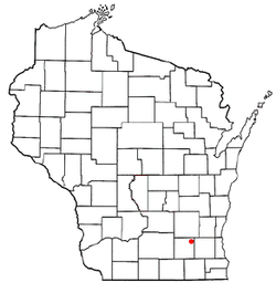 Location of Ixonia, Wisconsin | |
| Coordinates: 43°9′0″N 88°35′24″W | |
| Country | |
| State | |
| County | Jefferson |
| Organized | January 21, 1846 |
| Area | |
| • Total | 36.3 sq mi (93.9 km2) |
| • Land | 35.8 sq mi (92.7 km2) |
| • Water | 0.5 sq mi (1.3 km2) |
| Elevation | 866 ft (264 m) |
| Population (2010) | |
| • Total | 4,385 |
| • Density | 120/sq mi (47/km2) |
| Time zone | UTC-6 (Central (CST)) |
| • Summer (DST) | UTC-5 (CDT) |
| ZIP Code | 53036 |
| Area code(s) | 920 |
| FIPS code | 55-37600[2] |
| GNIS feature ID | 1583440[1] |
| Website | townofixonia |
History
The town of Union was separated from the township of Watertown on February 12, 1841. Five years later, Union was further divided into two new towns. The first town became known as Concord, and as the residents could not otherwise agree on a name for the second town, the name was chosen by drawing letters at random until a name could be formed from the letters. As a result, "Ixonia" was the name given to the town on January 21, 1846, and still remains the only town with this name in the United States.[4][5]
Notable people
- Edwin Coe, newspaper editor and politician[6]
- Jenkin Lloyd Jones, Unitarian minister and magazine editor
- Peter Morris, baseball player
- Dennis Streich, retired bread truck driver and distant relative to the famous dwarf, John Lewis, also of Ixonia
Geography
According to the United States Census Bureau, the town has a total area of 36.3 square miles (93.9 km2), of which 35.8 square miles (92.7 km2) is land and 0.50 square miles (1.3 km2), or 1.35%, is water.[7]
Demographics
| Historical population | |||
|---|---|---|---|
| Census | Pop. | %± | |
| 1980 | 2,905 | — | |
| 1990 | 2,789 | −4.0% | |
| 2000 | 2,902 | 4.1% | |
| 2010 | 4,375 | 50.8% | |
As of the census of 2000, there were 2,902 people, 1,047 households, and 864 families in the town. The population density was 80.7 people per square mile (31.2/km²). There were 1,082 housing units at an average density of 11.6 persons/km² (30.1 persons/sq mi). The racial makeup of the town was 98.55% White, 0.07% African American, 0.21% Native American, 0.31% Asian, 0.03% Pacific Islander, 0.28% from other races, and 0.55% from two or more races. 0.90% of the population were Hispanic or Latino of any race.
Of the 1,047 households 35.1% had children under the age of 18 living with them, 72.6% were married couples living together, 5.9% have a woman whose husband does not live with her, and 17.4% were non-families. 13.9% of households were one person and 5.0% were one person aged 65 or older. The average household size was 2.77 and the average family size was 3.05.
The age distribution was 25.4% under the age of 18, 7.5% from 18 to 24, 28.4% from 25 to 44, 28.8% from 45 to 64, and 9.8% 65 or older. The median age was 38 years. For every 100 females, there were 105.8 males. For every 100 females age 18 and over, there were 106.3 males.
The median household income was $58,629 and the median family income was $60,184. Males had a median income of $41,190 versus $28,125 for females. The per capita income for the town was $23,979. 1.5% of the population and 1.2% of families were below the poverty line. Out of the total people living in poverty, 2.8% are under the age of 18 and 2.5% are 65 or older.
References
- "US Board on Geographic Names". United States Geological Survey. 2007-10-25. Retrieved 2008-01-31.
- "U.S. Census website". United States Census Bureau. Retrieved 2008-01-31.
- "Profile of General Population and Housing Characteristics: 2010 Demographic Profile Data (DP-1): Ixonia town, Jefferson County, Wisconsin". United States Census Bureau. Retrieved October 9, 2012.
- History of the Town of Ixonia
- "Ixonia Heritage Book Index" Dodge/Jefferson Counties Genealogical Society
- 'Wisconsin Blue Book 1887,' Biographical Sketch of Edwin Coe, pg. 512
- "Geographic Identifiers: 2010 Demographic Profile Data (G001): Ixonia town, Jefferson County, Wisconsin". United States Census Bureau. Retrieved October 9, 2012.
External links
Municipalities and communities of Jefferson County, Wisconsin, United States | ||
|---|---|---|
| Cities | 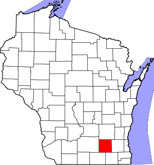 | |
| Villages | ||
| Towns | ||
| CDPs | ||
| Unincorporated communities |
| |
| Footnotes | ‡This populated place also has portions in an adjacent county or counties | |