Isselburg
Isselburg is a town in the district of Borken, in North Rhine-Westphalia, Germany. It is located on the river Issel, near the border of the Netherlands, and approximately 10 km west of Bocholt.
Isselburg | |
|---|---|
 Flag  Coat of arms | |
Location of Isselburg within Borken district 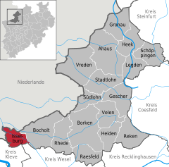  | |
 Isselburg  Isselburg | |
| Coordinates: 51°49′59″N 06°28′00″E | |
| Country | Germany |
| State | North Rhine-Westphalia |
| Admin. region | Münster |
| District | Borken |
| Subdivisions | 7 |
| Government | |
| • Mayor | Michael Carbanje (-) |
| Area | |
| • Total | 42.73 km2 (16.50 sq mi) |
| Elevation | 17 m (56 ft) |
| Population (2018-12-31)[1] | |
| • Total | 10,692 |
| • Density | 250/km2 (650/sq mi) |
| Time zone | CET/CEST (UTC+1/+2) |
| Postal codes | 46419 |
| Dialling codes | 0 28 74 |
| Vehicle registration | BOR |
| Website | www.isselburg.de |
Division
The largest villages are Anholt, Isselburg, and Werth. Smaller communities include Vehlingen, Herzebocholt and Heelden.
Local council (Stadtrat)
Elections in May 2014:
- SPD: 9 seats (-2)
- CDU: 11 seats (+1)
- Alliance 90/The Greens: 3 seats (±0)
- FDP: 3 seats (+1)
Mayors
| Term of office | |
|---|---|
| 1999 - 2004 | Margret Koch (SPD) |
| 2004 - 2011 | Adolf Radstaak (SPD) |
| 2012 - 2017 | Rudolf Geukes (SPD) |
| since 2018 | Michael Carbanje (none) |
Church at Anholt
St. Pankratius at Anholt (built 1851 – 1862)
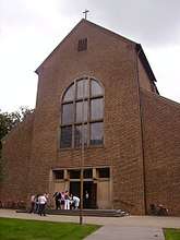 Church St. Pankratius at Anholt (Isselburg)
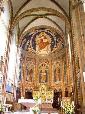 St. Pankraz in the Romanesque (revival) style
Gallery
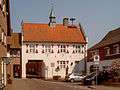 Werth, former town hall
 Anholt, Ratskeller, former town hall
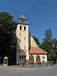 Anholt, church: Friedenskirche
 Isselburg, Ständebaum decorated as a maypole
References
- "Bevölkerung der Gemeinden Nordrhein-Westfalens am 31. Dezember 2018" (in German). Landesbetrieb Information und Technik NRW. Retrieved 10 July 2019.
| Wikimedia Commons has media related to Isselburg. |
Towns and municipalities in Borken (district) | ||
|---|---|---|
Coat of Arms of Borken district | ||
| Authority control |
|
|---|
This article is issued from Wikipedia. The text is licensed under Creative Commons - Attribution - Sharealike. Additional terms may apply for the media files.