Isabel, Kansas
Isabel is a city in Barber County, Kansas, United States. As of the 2010 census, the city population was 90.[6]
Isabel, Kansas | |
|---|---|
 Location within Barber County and Kansas | |
 KDOT map of Barber County (legend) | |
| Coordinates: 37°28′7″N 98°33′5″W | |
| Country | United States |
| State | Kansas |
| County | Barber |
| Founded | 1887 |
| Incorporated | 1909 |
| Area | |
| • Total | 0.25 sq mi (0.65 km2) |
| • Land | 0.25 sq mi (0.65 km2) |
| • Water | 0 sq mi (0 km2) |
| Elevation | 1,847 ft (563 m) |
| Population | |
| • Total | 90 |
| • Estimate (2016)[3] | 88 |
| • Density | 360/sq mi (140/km2) |
| Time zone | UTC-6 (CST) |
| • Summer (DST) | UTC-5 (CDT) |
| ZIP code | 67065 |
| Area code | 620 |
| FIPS code | 20-34550[4] |
| GNIS ID | 0470377[5] |
Geography
Isabel is located at 37°28′7″N 98°33′5″W (37.468706, -98.551325).[9] According to the United States Census Bureau, the city has a total area of 0.25 square miles (0.65 km2), all of it land.[1]
Isabel is located on the north county line, on the Mulvane extension of the Santa Fe, in Valley township.[10]
Demographics
| Historical population | |||
|---|---|---|---|
| Census | Pop. | %± | |
| 1910 | 222 | — | |
| 1920 | 341 | 53.6% | |
| 1930 | 279 | −18.2% | |
| 1940 | 252 | −9.7% | |
| 1950 | 205 | −18.7% | |
| 1960 | 181 | −11.7% | |
| 1970 | 147 | −18.8% | |
| 1980 | 137 | −6.8% | |
| 1990 | 104 | −24.1% | |
| 2000 | 108 | 3.8% | |
| 2010 | 90 | −16.7% | |
| Est. 2016 | 88 | [3] | −2.2% |
| U.S. Decennial Census | |||
2010 census
At the 2010 census there were 90 people in 40 households, including 23 families, in the city. The population density was 360.0 inhabitants per square mile (139.0/km2). There were 47 housing units at an average density of 188.0 per square mile (72.6/km2). The racial makeup of the city was 96.7% White, 2.2% from other races, and 1.1% from two or more races. Hispanic or Latino of any race were 4.4%.[2]
Of the 40 households 22.5% had children under the age of 18 living with them, 52.5% were married couples living together, 5.0% had a female householder with no husband present, and 42.5% were non-families. 37.5% of households were one person and 7.5% were one person aged 65 or older. The average household size was 2.25 and the average family size was 3.00.
The median age was 37.5 years. 21.1% of residents were under the age of 18; 6.8% were between the ages of 18 and 24; 32.3% were from 25 to 44; 22.3% were from 45 to 64; and 17.8% were 65 or older. The gender makeup of the city was 42.2% male and 57.8% female.
2000 census
At the 2000 census there were 108 people in 46 households, including 31 families, in the city. The population density was 429.9 people per square mile (166.8/km²). There were 53 housing units at an average density of 211.0 per square mile (81.9/km²). The racial makeup of the city was 93.52% White, 1.85% African American, 0.93% Native American, 0.93% from other races, and 2.78% from two or more races. Hispanic or Latino of any race were 0.93%.[4]
Of the 46 households 26.1% had children under the age of 18 living with them, 67.4% were married couples living together, and 32.6% were non-families. 30.4% of households were one person and 21.7% were one person aged 65 or older. The average household size was 2.35 and the average family size was 2.94.
The age distribution was 22.2% under the age of 18, 10.2% from 18 to 24, 19.4% from 25 to 44, 31.5% from 45 to 64, and 16.7% 65 or older. The median age was 44 years. For every 100 females, there were 86.2 males. For every 100 females age 18 and over, there were 82.6 males.
The median household income was $23,125 and the median family income was $27,917. Males had a median income of $24,375 versus $19,375 for females. The per capita income for the city was $12,795. There were 18.5% of families and 17.0% of the population living below the poverty line, including 36.4% of under eighteens and 6.9% of those over 64.
References
- "US Gazetteer files 2010". United States Census Bureau. Archived from the original on 2012-07-02. Retrieved 2012-07-06.
- "U.S. Census website". United States Census Bureau. Retrieved 2012-07-06.
- "Population and Housing Unit Estimates". Retrieved June 9, 2017.
- "U.S. Census website". United States Census Bureau. Retrieved 2008-01-31.
- "US Board on Geographic Names". United States Geological Survey. 2007-10-25. Retrieved 2008-01-31.
- "2010 City Population and Housing Occupancy Status". U.S. Census Bureau. Retrieved March 6, 2011.
- "Barber County". Blue Skyways. Kansas State Library. Archived from the original on 6 June 2014. Retrieved 4 June 2014.
- "Profile for Isabel, Kansas". ePodunk. Retrieved 4 June 2014.
- "US Gazetteer files: 2010, 2000, and 1990". United States Census Bureau. 2011-02-12. Retrieved 2011-04-23.
Further reading
External links
- City
- Schools
- USD 254, local school district
- Historical
- Isabel, Barber County, Kansas Barber County, Kansas: History and Genealogy
- Isabel Cemetery, Barber County, Kansas Barber County, Kansas: History and Genealogy
- Maps
- Isabel City Map, KDOT
Municipalities and communities of Barber County, Kansas, United States | ||
|---|---|---|
| Cities | 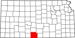 Map of Kansas highlighting Barber County | |
| Unincorporated communities | ||
| Townships | ||