Irvington Historic District (Irvington, Kentucky)
The Irvington Historic District in Irvington, Kentucky is a 12.6 acres (5.1 ha) historic district which was listed on the National Register of Historic Places in 1998.[1]
Irvington Historic District | |
 | |
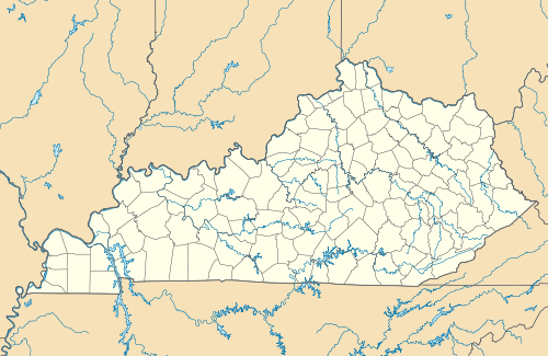  | |
| Location | Roughly bounded by CSX tracks, Third, Caroline and Walnut Sts., Irvington, Kentucky |
|---|---|
| Coordinates | 37°52′56″N 86°17′04″W |
| Area | 12.6 acres (5.1 ha) |
| Built | 1888 |
| Architectural style | Early Commercial, Late 19th and Early 20th Century American Movements |
| NRHP reference No. | 97001342[1] |
| Added to NRHP | June 29, 1998 |
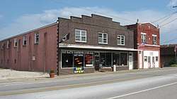
It is roughly bounded by CSX tracks, Third, Caroline and Walnut Streets. It included 20 contributing buildings, 12 contributing structures, and three contributing sites. Interspersed are fourteen non-contributing buildings and a non-contributing site. It even included a U.S. Post Office.[2]
It was deemed significant as the "most cohesive group of early commercial buildings that formed one of Breckinridge County's most prosperous railroad towns that continues to thrive today." Most of the buildings are one- and two-story brick structures.[2]
References
- "National Register Information System". National Register of Historic Places. National Park Service. November 2, 2013.
- Donna G. Logsdon (July 28, 1997). "National Register of Historic Places Registration: Irvington Historic District". National Park Service. Retrieved April 21, 2018. With accompanying 13 photos
| Topics | |
|---|---|
| Lists by state |
|
| Lists by insular areas | |
| Lists by associated state | |
| Other areas | |
| Related | |
| |
This article is issued from Wikipedia. The text is licensed under Creative Commons - Attribution - Sharealike. Additional terms may apply for the media files.