Irele
Ikale or old Ikale local government is Yoruba tribes in Ondo state Nigeria.It originally included what is now irele Local government. Which was split into Irele and Okitipupa local government. Irele is a Local Government Area in Ondo State, Nigeria. Its headquarters are in the town of Ode-Irele.
Irele-Ikale Ikale Ode Irele | |
|---|---|
LGA and town | |
 Irele-Ikale Location in Nigeria | |
| Coordinates: 6°29′0″N 4°52′0″E | |
| Country | |
| State | Ondo State |
| Time zone | UTC+1 (WAT) |
It has an area of 963 square kilometres (372 sq mi) and had a population of 145,166 at the 2006 census.
- The rulers of Ikale kingdom
- Abodi of Ikale land Paramount Rulers of Ikale land
- Olofun Of Irele
- Odogbo Of Omi
- Larogbo Of Akotogbo
- Ababa Of Ajagba
- Laragunshin Of Iyansan
- Lighogho Of Iju-osun
The postal code of the area is 352.[1]
Notes and references
- "Post Offices- with map of LGA". NIPOST. Archived from the original on 7 October 2009. Retrieved 20 October 2009.
State capital: Akure | ||
| Local Government Areas | 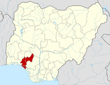 | |
This article is issued from Wikipedia. The text is licensed under Creative Commons - Attribution - Sharealike. Additional terms may apply for the media files.