Iratais Point
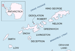
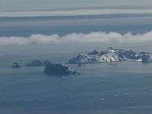
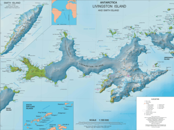
Iratais Point (Nos Iratais \'nos i-ra-'ta-is\) is a point forming both the south extremity and the vertex of the V-shaped Desolation Island situated in the entrance to Hero Bay, Livingston Island, Antarctica. Separated from Miladinovi Islets to the south by Neck or Nothing Passage.
The feature is named after Kavhan (hereditary viceroy function) Iratais, governor of the southern Bulgarian Black Sea region under Khan Krum the Horrible (9th century AD).
Location
The point is located at 62°28′10″S 60°20′16″W which is 3.33 km south-southeast of Cape Danger, 10.55 km west-southwest of Williams Point, 9.75 km north-northeast of Siddins Point and 23.27 km east by south of Cape Shirreff (British mapping in 1968, and Bulgarian in 2005 and 2009).
Maps
- L.L. Ivanov et al. Antarctica: Livingston Island and Greenwich Island, South Shetland Islands. Scale 1:100000 topographic map. Sofia: Antarctic Place-names Commission of Bulgaria, 2005.
- L.L. Ivanov. Antarctica: Livingston Island and Greenwich, Robert, Snow and Smith Islands. Scale 1:120000 topographic map. Troyan: Manfred Wörner Foundation, 2009. ISBN 978-954-92032-6-4
- Antarctic Digital Database (ADD). Scale 1:250000 topographic map of Antarctica. Scientific Committee on Antarctic Research (SCAR). Since 1993, regularly upgraded and updated.
- L.L. Ivanov. Antarctica: Livingston Island and Smith Island. Scale 1:100000 topographic map. Manfred Wörner Foundation, 2017. ISBN 978-619-90008-3-0
References
- Iratais Point. SCAR Composite Gazetteer of Antarctica
- Bulgarian Antarctic Gazetteer. Antarctic Place-names Commission. (details in Bulgarian, basic data in English)
External links
- Iratais Point. Copernix satellite image
This article includes information from the Antarctic Place-names Commission of Bulgaria which is used with permission.