Interstate 80 in Nebraska
Interstate 80 (I-80) in the U.S. state of Nebraska runs east from the Wyoming state border across the state to Omaha. When it completed construction of the stretch of I-80 spanning the state on October 19, 1974, Nebraska was the first state in the nation to complete its mainline Interstate Highway System.[4]
| ||||
|---|---|---|---|---|

I-80 highlighted in red | ||||
| Route information | ||||
| Maintained by NDOT | ||||
| Length | 455.31 mi[1][2] (732.75 km) | |||
| Existed | 1957[3]–present | |||
| Major junctions | ||||
| West end | ||||
| East end | ||||
| Location | ||||
| Counties | Kimball, Cheyenne, Deuel, Keith, Lincoln, Dawson, Buffalo, Hall, Hamilton, York, Seward, Lancaster, Cass, Sarpy, Douglas | |||
| Highway system | ||||
| ||||

Nebraska has over 80 exits along Interstate 80.[5] According to The New York Times there are several notable tourist attractions along Nebraska's section of I-80.[6] It is the only Interstate Highway in the state to go from one end of the state to another, as Nebraska has no major north–south interstate route. Except for a 3-mile-long (4.8 km) portion of I-76 near the Colorado state line, I-80 is the only primary (two-digit) Interstate Highway in Nebraska.
History
Built along the pathway of the Great Platte River Road, I-80 in Nebraska follows the same route as many historic trails, including the Oregon Trail, the California Trail, and the Mormon Trail.[6] Starting in 1957 after federal funding was allotted, Nebraskans began planning their Interstate construction. Led by the Nebraska State Highway Commission, there were hearings across the state to decide where the route was going to be. Aside from the federally mandated "control points" in Omaha and Scottsbluff, the route could vary across the state. Dozens of meetings were held in Grand Island, Kearney, and North Platte, among other locations. The commission addressed issues of whether the highway would be north or south of the Platte River or whether it would follow U.S. Highway 30. The South Platte Chamber of Commerce and various cities were very active in these sessions, and debate over where the Interstate would be constructed continued into the 1960s.[3]
After the first contract for building the Interstate was awarded in 1957, a 6.5-mile (10.5 km) section near Gretna was the first section to be completed that year.[7] The first long segment to be opened was a 50-mile (80 km) section between Dodge Street in Omaha and the West Lincoln interchange in Lincoln in 1961.[8] During a "Golden Link" ceremony, the last section of I-80 in Nebraska was completed when a brass connector was inserted in the roadway near Sidney on April 1, 1974.[4] This was designed to emulate the golden spike ceremonially used to complete the Trancontinental Railroad in 1869.[9]
The total length of the Nebraska section is 455.27 miles (732.69 km) long, and was completed at a cost of $435 million.[4]
Legacy
The beginning of the I-80 construction in Nebraska in 1957 led the Nebraska Legislature to split the Department of Roads and Irrigation in order to create three separate agencies in the state, including the Department of Motor Vehicles, Department of Water Resources and the Department of Roads, which was the first Nebraska agency solely responsible for highway planning, construction, and maintenance in Nebraska history.[10]
Interstate construction led the state to focus on other highways in Nebraska, as well. Surfaced shoulders, new safety sections beyond shoulders and other developments across the state were attributed to the influence of the Interstate.[11] The 1965 state legislature also authorized a study of the needs of every public road in Nebraska, including state highways, county roads, and city streets.[12]
Speed limits
The following are speed limits that have existed on I-80 in Nebraska since it was opened in 1957.[13]
| Year | Speed limit(s) |
|---|---|
| 1960 | 70 mph (115 km/h) |
| 1964 | 75 mph (120 km/h) for cars and 65 mph (105 km/h) for trucks |
| 1974 | 55 mph (90 km/h) national speed limit, effective March 3, 1974 |
| 1987 | 65 mph (105 km/h) |
| 1995 | 75 mph (120 km/h) |
Route description
Designated sections
The entirety of the Interstate Highway System was named the "Dwight D. Eisenhower System of Interstate and Defense Highways" in 1990, and the first signage in Nebraska was posted in 1993.[14] Several sections of I-80 in Nebraska have special designations. The I-80 intersection with US-34 has been designated a "Purple Heart Memorial Highway", and South 108th Street bridge over I-80 in Omaha has been designated the "Purple Heart Bridge", both in honor of all recipients of the Purple Heart.[15] A section of I-80 in Nebraska is also designated as a Blue Star Memorial Highway.
Details
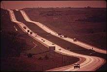
In Nebraska, I-80 has 82 interchanges, 442 bridges on or over the roadway, 25 rest areas, and one scenic overlook, each spaced 35–50 miles (56–80 km) apart for convenience. The I-80 rights-of-way in Nebraska feature 28 types of grasses and forbs, 31 types of shrubs, 12 varieties of coniferous trees, and 39 types of deciduous trees are planted on the median of I-80 in Nebraska. There are also 570 informational and directional signs along the way.[16] Mile markers with the interstate shield are posted every 1⁄5 mile (0.32 km) beginning at mile 379.0 going east. Most of the route is straight plains, and a stretch between Lincoln and Grand Island is almost entirely straight with very few curves whatsoever.
Exit list
| County | Location | mi[1] | km | Exit | Destinations | Notes |
|---|---|---|---|---|---|---|
| Kimball | | 0.00 | 0.00 | Continuation into Wyoming; proposed toll road for the entire route of I-80 in WY[17] | ||
| | 0.48 | 0.77 | 1 | |||
| Bushnell | 8.46 | 13.62 | 8 | |||
| | 20.71 | 33.33 | 20 | Western end of N-71 overlap | ||
| | 22.69 | 36.52 | 22 | Eastern end of N-71 overlap | ||
| Dix | 29.76 | 47.89 | 29 | |||
| Cheyenne | Potter | 38.96 | 62.70 | 38 | ||
| | 48.82 | 78.57 | 48 | |||
| | 51.31 | 82.58 | Sidney Rest Area (eastbound); location of the Golden Link[18] | |||
| Sidney | 55.37 | 89.11 | 55 | N-19 north is former I-80 Bus. east | ||
| 59.92 | 96.43 | 59 | Former I-80 Bus. west | |||
| Sunol | 69.63 | 112.06 | 69 | |||
| Lodgepole | 76.61 | 123.29 | 76 | |||
| Deuel | Chappell | 85.22 | 137.15 | 85 | ||
| | 95.02 | 152.92 | 95 | |||
| | 101.19 | 162.85 | 101 | |||
| | 102.59 | 165.10 | 102 | Left exit westbound, left entrance eastbound | ||
| Big Springs | 107.36 | 172.78 | 107 | |||
| Keith | Brule | 117.25 | 188.70 | 117 | ||
| Ogallala | 126.69 | 203.89 | 126 | Eastern terminus of US 26 | ||
| Roscoe | 133.97 | 215.60 | 133 | |||
| Paxton | 145.65 | 234.40 | 145 | |||
| Lincoln | Sutherland | 158.01 | 254.29 | 158 | ||
| Hershey | 164.51 | 264.75 | 164 | |||
| North Platte | 177.16 | 285.11 | 177 | |||
| 179.19 | 288.38 | 179 | ||||
| Maxwell | 190.42 | 306.45 | 190 | |||
| Brady | 198.97 | 320.21 | 199 | |||
| Dawson | Gothenburg | 211.77 | 340.81 | 211 | ||
| Cozad | 222.46 | 358.01 | 222 | |||
| | 231.10 | 371.92 | 231 | |||
| Lexington | 237.19 | 381.72 | 237 | |||
| Overton | 248.53 | 399.97 | 248 | |||
| Buffalo | Elm Creek | 257.01 | 413.62 | 257 | ||
| Odessa | 263.66 | 424.32 | 263 | |||
| Kearney | 272.60 | 438.71 | 272 | |||
| 275.59 | 443.52 | 275 | Western end of N-10 overlap | |||
| | 279.89 | 450.44 | 279 | Eastern end of N-10 overlap | ||
| Gibbon | 285.63 | 459.68 | 285 | |||
| Shelton | 291.36 | 468.90 | 291 | |||
| Hall | Wood River | 300.10 | 482.96 | 300 | ||
| | 305.66 | 491.91 | 305 | |||
| Grand Island | 312.07 | 502.23 | 312 | |||
| 314.11 | 505.51 | 314 | Locust Street – Grand Island | |||
| Hamilton | | 318.14 | 512.00 | 318 | ||
| Giltner | 324.14 | 521.65 | 324 | |||
| Aurora | 332.15 | 534.54 | 332 | |||
| Hampton | 338.12 | 544.15 | 338 | |||
| York | Henderson | 342.11 | 550.57 | 342 | ||
| | 348.09 | 560.20 | 348 | |||
| York | 353.09 | 568.24 | 353 | |||
| | 360.11 | 579.54 | 360 | |||
| Seward | | 366.13 | 589.23 | 366 | ||
| Beaver Crossing | 369.12 | 594.04 | 369 | |||
| Goehner | 373.09 | 600.43 | 373 | |||
| | 379.08 | 610.07 | 379 | |||
| Milford | 382.08 | 614.90 | 382 | |||
| | 388.11 | 624.60 | 388 | |||
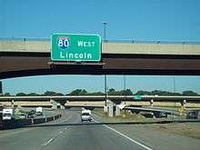
| Lancaster | Lincoln | 395.59 | 636.64 | 395 | ||
| 396.36 | 637.88 | 396 | Closed; was eastbound exit and westbound left entrance only[19] | |||
| 397.27 | 639.34 | 397 | Western end of US 77 overlap | |||
| 399.01 | 642.14 | 399 | NW 12th Street / Cornhusker Highway / Adams Street – Lincoln Airport | |||
| 401.04 | 645.41 | 401 | Eastbound exits signed as 401A (south/east) and 401B (west) | |||
| 403.48 | 649.34 | 403 | 27th Street | |||
| | 405.75 | 652.99 | 405 | Eastern end of US 77 overlap; L-55X is former US 77 south | ||
| Waverly | 409.74 | 659.41 | 409 | |||
| Cass | Ashland | 420.91 | 677.39 | 420 | ||
| 426.06 | 685.68 | 426 | Mahoney State Park | |||
| Platte River | 427.26 | 687.61 | Bridge | |||
| Sarpy | | 432.94 | 696.75 | 432 | ||
| | 439.19 | 706.81 | 439 | Werner Park (stadium), Offutt Air Force Base | ||
| Chalco | 440.63 | 709.13 | 440 | |||
| 442.89 | 712.76 | 442 | Giles Road / Harrison Street | |||
| Douglas | Omaha | 444.56 | 715.45 | 445 | Q Street | Westbound exit only; access from C/D lanes originating at West Center Rd. exit |
| 445.05 | 716.24 | Cloverleaf interchange accessible to and from C/D lanes | ||||
| 445.34 | 716.71 | I Street | Westbound exit and eastbound entrance accessible to and from C/D lanes | |||
| 445.97 | 717.72 | 446 | ||||
| 446.63 | 718.78 | 445 | West Center Road | No eastbound exit; C/D lanes provide access to I-L-Q St. exits | ||
| 448.29 | 721.45 | 448 | 84th Street | |||
| 449.30 | 723.08 | 449 | 72nd Street | |||
| 450.31 | 724.70 | 450 | 60th Street | |||
| 451.83 | 727.15 | 451 | 42nd Street | |||
| 452.85 | 728.79 | 452 | Exits to southbound US 75 also include direct exit ramp onto F Street | |||
| 453.04 | 729.10 | 453 | 24th Street | Eastbound exit and westbound entrance | ||
| 454.14 | 730.87 | 454 | 13th Street – Gardens, Zoo | Former US 73 / US 75 | ||
| Missouri River | 455.31 | 732.75 | Interstate 80 Bridge; Nebraska–Iowa state line | |||
| Continuation into Iowa | ||||||
1.000 mi = 1.609 km; 1.000 km = 0.621 mi
| ||||||
Auxiliary routes
Interstate 80 has three auxiliary routes in Nebraska. One is a loop around the city of Omaha, one is a loop through the city of Omaha, and the other is a spur into Lincoln.


See also
- History of Nebraska
- Transportation in Omaha, Nebraska
References
Footnotes
- "Nebraska Highway Reference Log Book" (PDF). Nebraska Department of Roads. 2015. pp. 202–223. Retrieved January 8, 2017.
- Staff (October 31, 2002). "Table 1: Main Routes of the Dwight D. Eisenhower National System of Interstate and Defense Highways as of October 31, 2002". Route Log and Finder List. Federal Highway Administration. OCLC 47914009.
- Koster (1997), p. 64.
- Staff. "Interstate Construction in Nebraska". Nebraska Department of Roads. Retrieved September 23, 2007.
- Geelhart, Chris (July 11, 2006). "Highways 61-100". Nebraska Highways Page. Self-published. Retrieved October 14, 2007.
- Winckler, Suzanne (July 22, 1990). "I-80's Exits to History in Nebraska". The New York Times. Retrieved September 23, 2007.
- Koster (1997), p. 66.
- Nebraska Interstate 80 Lincoln–Omaha (PDF). Nebraska Department of Roads. August 11, 1961. Retrieved September 23, 2007.
- Koster (1997), p. 87.
- Koster (1997), p. 67.
- Koster (1997), p. 73.
- Koster (1997), p. 75.
- Koster (1997), p. 94.
- Koster (1997), p. 100.
- Staff. "Purple Heart Trail". Nebraska Department of Roads. Retrieved September 23, 2007.
- Staff. Today's I-80 in Nebraska. Nebraska Department of Roads. Retrieved December 20, 2013.
- Scott, Ramsey (April 14, 2019). "Wyoming Legislature could take another look at tolling I-80". Wyoming Tribune Eagle. Retrieved April 26, 2019.
- WanderingRaleighite. "The Golden Link Historical Marker/Historic Landmark in Sidney, Cheyenne, NE, US". Landmarks Visited Catalog. Self-published. Archived from the original on April 2, 2015. Retrieved March 4, 2014.
- "Nebraska 511 Traveler Information". Nebraska Department of Roads. Retrieved January 22, 2016.
Works cited
- Frazier, Ian (1989). Great Plains. New York: Farrar Straus Giroux. ISBN 9780374217235.CS1 maint: ref=harv (link)
- Koster, George E. (1997). A Story of Highway Development in Nebraska (PDF) (Revised ed.). Lincoln: Nebraska Department of Roads. p. 64. OCLC 38025727. Retrieved September 23, 2007.CS1 maint: ref=harv (link)
- Mattes, Merrill J. (1969). The Great Platte River Road. Lincoln: University of Nebraska Press. OCLC 92978.CS1 maint: ref=harv (link)
- Nebraska State Historical Society (1989). Historic Places: The National Register for Nebraska. Lincoln: Nebraska Game and Parks Commission. OCLC 19216708.CS1 maint: ref=harv (link)
External links
| Wikimedia Commons has media related to Interstate 80 in Nebraska. |
- Nebraska Department of Roads
- 1963 photos of construction in Omaha.
- I-80 Nebraska. An official promotional website for nine counties in central and western Nebraska.
| Previous state: Wyoming |
Nebraska | Next state: Iowa |