Indian Cave State Park
Indian Cave State Park is a public recreation and historic preservation area covering nearly 3,400 acres (1,400 ha) along the Missouri River in southeast Nebraska. The state park preserves a cave with prehistoric petroglyphs as well as the partially reconstructed village of St. Deroin established in 1853 as part of the former Nemaha Half-Breed Reservation.[4] The state park lies ten miles (16 km) south of Brownville and eight miles (13 km) east of Shubert, straddling the county line between Nemaha and Richardson counties.[5]
| Indian Cave State Park | |
|---|---|
.jpg) Indian Cave rock shelter and petroglyphs | |
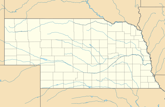 Location in Nebraska | |
| Location | Missouri River, Southeastern Nebraska, United States |
| Nearest town | Shubert, Nebraska |
| Coordinates | 40°15′10″N 95°33′16″W[1] |
| Area | 3,399.7 acres (1,375.8 ha)[2] |
| Elevation | 1,115 ft (340 m)[1] |
| Designation | Nebraska state park |
| Established | 1962[3] |
| Administrator | Nebraska Game and Parks Commission |
| Website | Indian Cave State Park |
Some of the carvings within Indian Cave are believed to be several thousand years old, but their exact period and cultural affiliations are undetermined. The park offers 22 miles of hiking and biking trails, 16 miles of equestrian trails, camping, picnic facilities, fishing areas, and boating access to the Missouri River.[4]
References
- "Indian Cave State Park". Geographic Names Information System. United States Geological Survey.
- "Indian Cave State Park". NGPC Map and Data Portal. March 1, 2017. Retrieved June 9, 2020.
- "Indian Cave State Park Brochure" (PDF). Nebraska Game and Parks Commission. May 2008. Archived from the original (PDF) on May 28, 2015. Retrieved April 30, 2011.
- "Indian Cave State Park". Nebraska Game and Parks Commission. Retrieved January 6, 2017.
- "Indian Cave State Park". Visit Nemaha County. Archived from the original on February 10, 2008. Retrieved January 24, 2010.
External links
- Indian Cave State Park Nebraska Game and Parks Commission
- Indian Cave State Park Map Nebraska Game and Parks Commission
| Historic and present tribes | |
|---|---|
| Present languages |
|
| Present reservations | |
| Present tribal colleges and universities | |
| Historic figures |
|
| Historic events | |
| Historic reservations | |
| Historic communities |
|
| Historic sacred places |
|
| Other historic places |
|
| Precontact peoples |
|
| Precontact communities |
|
| Other precontact places |
|
| Other topics | |